Maps at Brooklyn Historical Society- “The Heart Of Brooklyn”

1-What is the map’s call number?

BA-[194-3].F1

2-What is the map’s title (if available)?

The Heart Of Brooklyn

3-Which collection does the map belong to?

Flat Maps

4-When was it made?

In the 1940’s

Physical description of the map:
5-What size is the map (approximately)?

14 inches by 22 inches

6-What colors does it use?

Gray, Pink, Green, Orange, Red, Blue, White, Yellow, Purple

7-What materials were used to make the map?

Paper

8-Who made the map?

It was printed by Hagstrom Company,Inc.,N.Y.C.Map Makers,Map Publishers. It was made by the Brooklyn Trust Company

Map content:
9-What location does the map depict?

Brooklyn Heights

10-What details does it include?

Retail stores, Theaters, Business and Finance, Automobile parking

11-What time period does the map depict? Is this the same as the time when it was made?

It depicts the 1940’s and it seems it was made around the same time

12-What is familiar to you about the location depicted in the map?

All the streets and designed areas seem similar to current

Interpretation and Reflection:
13-What is the purpose of the map?

To attract people to the area of Brooklyn for tourism

14-Why did it survive prior to becoming part of the archives at BHS?

It is very informative and was probably useful from when it was made until today

15-Why did BHS incorporate it into its collections?

It has to do with Brooklyn

16-What is familiar or unfamiliar about the map?

Everything is familiar street-wise. The style of cars and clothes is from an older time

17-What additional information would you want to better understand the map?

A scale

18-Where is City Tech in relation to this map?

The intersection of Johnson and Pearl street


Summary of SPE Class-10-16-13

Today in Effective speaking class Professor Davis let us do peer review on our outline that was due today. We were supposed to review for the midterm but we did that instead. He told us that the midterm is gonna be on Monday and it will consist of 35 multiple choice questions and 15 true and false questions. It will cover chapters one through six. In the peer review we had it helped a lot we got to work one and one with a classmate and they gave you back a feedback on your outline. Like if it needed more details or if something is missing. Also if you wanted prof. Davis gave you a feedback too that even helped more and made it more clearer on what else you needed in your outline. Then he decided since we didn’t review for the midterm today we can review on Monday morning from 9-10. You have to meet him in his office before 9 which is located in A-630 and then we will go review in another room. The last thing we did was he passed around a sheet of paper that had our names and what day we had to go for the speech either 10-28 or 10-30. On 10-28 we have a double session of effective speaking so more people will be going on that day rather on the 30th.

Summary of our DS on Oct. 15th

Today we started class by meeting in front of the school bookstore just like we did for the first visit to BHS. This time, instead of walking through the residential part of Brooklyn Heights and passing through the promenade, we walked straight through the square and down Montague. It is actually very close despite what our first visit lead us to believe. Once we got there, we went straight up the first flight of stairs to the Library. It was set up differently than the first visit because there were tables in the middle instead of just lined-up chairs. I asked Liz about this and she said that it was because somebody had rented the space prior to our first visit. We proceeded to get into our groups and await instruction. There were three maps on each table and they were very old, so they were encased in some plastic film that would keep its integrity. Although they were somewhat protected, we still had to be very careful lifting and moving them. No pencils were permitted near the maps, even to point. We were given a handout that had questions pertaining to the maps and the information they provided. There wasn’t enough time for all the maps because the class was only so long. Some groups also has people absent so they didn’t have as many eyes and input as others. We began to analyze these maps and answer the questions. My group was successful in answering the questions but had a little disagreement directionally about one of the maps. This shows the importance of a compass in any map. After we finished filling out our answers, we were unexpectedly told that we were to, as a group, provide an impromptu speech about the information we gathered. There were five groups and I believe each was successful in informing the class about the maps they had analyzed.

Maps at Brooklyn Historical Society

1-What is the map’s call number?

Pierrepont – [18-?] a. Fl

2-What is the map’s title (if available)?

Map Of Some Streets On Brooklyn Heights

3-Which collection does the map belong to?

Pierrepont

4-When was it made?

1800s

Physical description of the map:
5-What size is the map (approximately)?

1 1/2 ft. by 2 1/4 ft.

6-What colors does it use?

Black and white

7-What materials were used to make the map?

Parchment, black ink, and pencil.

8-Who made the map?

M.B.

Map content:
9-What location does the map depict?

Brooklyn Heights

10-What details does it include?

Properties, sizes, and streets.

11-What time period does the map depict? Is this the same as the time when it was made?

1800s, the same time the map was made

12-What is familiar to you about the location depicted in the map?

Fulton Street and Court Street

Interpretation and Reflection:
13-What is the purpose of the map?

To show properties and street locations

14-Why did it survive prior to becoming part of the archives at BHS?

Maybe the map was made by somebody of great importance or somebody decide it would be useful in the future.

15-Why did BHS incorporate it into its collections?

The map is of Brooklyn Heights and it is relevant to the society

16-What is familiar or unfamiliar about the map?

Court street, Fulton street, and Public Square are familiar. Some of the alley ways and other streets do not exist today.

17-What additional information would you want to better understand the map?

A legend, compass, and scale.

18-Where is City Tech in relation to this map?

City Tech is not on this map but if it showed you Northeast of Public square, it would just be a couple blocks away.

View of the world from the 9th Avenue

On this map we can see how the author feels that how NYC city is different from all of the other states or cities. He views this map from the vintage point of 9th avenue and he covers the 10ths avenue. The two avenues are filled with traffics, people, and buildings. Than the map shows the Hudson river and than few other states such as Jersey, Las Vegas, Nebraska and also includes some cities. The area that covers these sates or cities is a plain area. Than he jus has the border line of Mexico ,Canada  and he also includes the countries such as Russian, Japan and china. All of these areas are just there nothing really to look at. this tells the message that the author is to show you here. New York is more attractive, fun or busy than all the states or cities together. He shows how the other cities or states are not busy like New York is. He shows the difference of the Live New York compared to dull other cities or sates. He means that new York is more busier and it is fun.

The happiest and the saddest place in New York

The happiest place? well the first thing that comes to mind when I think the happiest place is Times Square. I think it is the happiest place for me because that is the main attraction of New York City. No matter what the time is that place will be live and it is always fun going there. On Christmas there is also a Christmas tree there and that whole area just looks amazing. I always have fun and just enjoy my time while I am there and it makes me happy. Than there are all the stores to shop at. It is just an amazing place and it always makes me happy when I go there.

The saddest place in New York for me would be the walking place near sears bay in Brooklyn. It is a walking place right next to the ocean and I think it is sad because that is a place where somebody will go to when they are sad or stressed about something. I use to work around there and would go there when I was stressed or any kind of tension in my mind.

10-02-13 summary

Today we had another joint session to visit the city tech college library. It was really nice to see how big our library was and also the resources the library provides us to work with for our studies. We learned how to search for information online and using the books to search for information to help us with our research. We learned how to use search engines like Google and find information. We should use important key words so we will find more narrowed results and also more credible. We should avoid Wikipedia since many people use that and it is also editable by anybody. Than we learned how to use the library catalog to find books that an help us with our research. We should use the authors name or search more specifically by using the key words from the title of the book. Than we also learned about he citation of work we do. We learned about the different styles that are used while citing work and why it is important to cite our work.

Cover letter for Project 2

Please write a letter addressed to me that will help me understand your work on Project #2. It should answer the following questions in any order you like:

1-what are you most proud of in your essay?

2-what in your essay still needs work?

3-what in the assignment gave you the most trouble?

4-what stands out to you from completing this assignment?

5-is there anything I should know about you as a writer, student etc that will help me as I read your essay?

If you have not yet submitted your essay, please explain why, when you will, and use the letter as an opportunity to let me know what’s giving you trouble.

Prison Ship Martyr Monument

I am new to the area of Brooklyn so coming to City Tech was a little bit of scary thing for me. After my trip to the Brooklyn Historical Society, I became very interested in what else Brooklyn had to offer. Therefore, as I started my personal walking tour in FortGreene I stumbled upon a Giant tower like figure. I soon learned that this was the Prison Ship Martyrs Monument. This monument stands for a New Jersey Militia during the American Revolution that soon became Prisoners on board a British vessel.prison_ship_martyrs_fort_greene_park_brooklyn

Getting to to the prison ship monuement was not that hard even though I am not familar with the area of Brooklyn. From City Tech I go to Johnson street. On your way you should see the polytechnic institute of technology. It is a very prestigous building with high honor. When you keep going a little further you are going to make a right onto Flatbush Avenue. You will see a small metropolitan market as you make an upcoming left onto Myrtle avenue. Long Island University is will then come up on the left. I gave it a good look as i was most impressed with the school. Finally when you get to Fort Greene.

The remains of these prisoners were decided to be built in a 25 by 11 foot brick vault because of how important the preservation of this was. In 1905, a crypt was created where you can go up a flight of stairs that go around the monument. This was made so that it could be honored properly by all people who came to visit. The man who sculpted it was Adolph Alexander Weinman in 1908. An elevator and stairs for the interior were installed in 1937; both were removed in 1948 after the monument was renovated by Parks. In 1970 the elevator pit was filled in.

            During the American Revolution, The British imprisoned all Americans that were mostly soldiers because of independence. The conditions upon the ship were said to be horrendous and many soldiers died because of it. When the war ended, the deaths were said to be in the tens of thousands. That is why this memorial is significant. It is because of the brutality that these soldiers had to go through just to fight for our freedom. In 1783, a local newspaper tried to deny these actions and said “they were allowed to leave whenever they pleased”. America said this was propaganda, which is news, or anything that is heard a lie. The number of deaths which was 10,000 plus was a big deal considering a large army back then was about 14,000. The prisoners wrote down memoirs too explaining every detail of what was going on.

             The memorial lies in Brooklyn and cannot be missed considering its great size. It is sited in FortGreenePark and it holds a crypt, which is a kind of grave. It is located inside the monument, which has stairs between the middle of it that you can climb. It is over 140 feet high and can blend in with some of the surrounding buildings. Inside the crypt contains many wooden coffins of some of the prisoners. Not all if the bodies are in there as some of them weren’t found or could not be preserved.

The monument also has an inscription on it which states “IN THE NAME OF THE SPIRITS OF THE DEPARTED FREE / SACRED TO THE
MEMORY OF THAT PORTION OF AMERICAN SEAMEN, SOLDIERS / ON BOARD THE
PRISON SHIPS OF THE BRITISH DURING THE REVOLUTIONARY / WAR AT THE
WALL ABOUT. THIS IS THE CORNERSTONE OF THE VAULT / WHICH CONTAINS
THEIR RELICS. ERECTED BY THE TAMMANY SOCIETY/OF THE COLUMBIAN
ORDER OF THE CITY OF NEW YORK. THE GROUND FOR / WHICH WAS BESTOWED
BY JOHN JACKSON, NASSAU ISLAND, SEASON OF/BLOSSOMS, YEAR OF
DISCOVERY, THE 316TH. OF THE INSTITUTION THE 19TH AND OF AMERICAN
INDEPENDENCE THE 32ND, APRIL THE 6TH, 1808”

It states that the importance of this prison tower cannot be tampered with and it is part of the city. Brooklyn has a rich history and the Prison ship martyr monument in Fort Greene Park is a big part of that.

Sources:  http://www.nycgovparks.org/parks/FortGreenePark/monuments/1222 -My quote

http://www.themorningnews.org/post/prison-ship-martyrs-monument


A first time walk experience in Brooklyn


3924813078_fb79b2294d

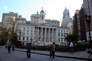
Just a few steps from our campus City tech across Adams St there is a beautiful park that lets you experience both sides of Brooklyn. While standing on Johnson Street I could not help but notice a beautiful building facing Columbus Park. It was a court house with old architecture, something worth appreciating these days because the big fancy condominiums with huge windows are becoming very common in Brooklyn, Especially along the coast. Here you have this area with a mix of historic buildings and modern condominiums. The same goes for the residents, there are all kinds of people from broke college students to families buying clothing for their children. The area seems to be flooded with luxury buildings, vintage buildings, and Brooklyn natives shopping. Walking down Cadman Plaza I started to really notice how modern this area is and how the big pillars from the Brooklyn Borough president building add historic value to the neighborhood. The thing that really stands out about this area is how history and present mix and it shows that it’s a thriving neighborhood with a growing economy and diverse community.

With all the vintage buildings, countless small businesses and street vendors this area started to feel like a mini Manhattan. Even though every borough has its own distinction about it, every borough has a New York City influence. While standing on the corner of Court Street and Fulton, I decided to walk east towards the Fulton mall because that area was busy and there were a lot of people and I wanted to get an idea of what it’s like here. As I walked further down Fulton I came across a very busy intersection at the entrance of the Fulton street mall I saw many Latino and black families doing shopping for their children, there were a lot of clothing and shoe stores in old vintage Brooklyn style apartment buildings with fine details. It seems like the businesses adapted to the needs of the residents in this part of Brooklyn. Many of the businesses here target average families living in Brooklyn and do business with people from all over New York as well. It’s obvious that this area has grown a lot from what it used to be. The changes are in plain sight, based on the important court buildings and old Brooklyn style apartment buildings; this area was meant to be a busy area. It’s developed so much over the years you can see the newly built modern stores right next to iconic buildings that have been standing there for decades. Its slowly becoming modernized but the beautiful historic parts of Brooklyn are there to stay as a reminder of how our society is changing and always adapting to the present its true for everyone who has lived in New York that “we become New Yorkers the day we realize New York will go on without us” its shown by the rapid growth in this area nearby city tech, the same people living here going on with their daily tasks are the same ones who spent time building their lives and establishing themselves in this economy as New Yorkers and no matter how different the neighborhood may look decades from now it will be known for its community of New Yorkers who have lived through the changes and have seen the city grow and adapt.

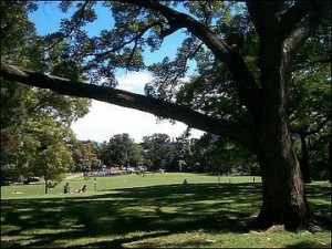
Walking through the Fulton street has taught me a lot about the community surrounding city tech and as I reached the end of the shopping center I turned to DeKalb, I couldn’t help but notice a massive building with Greek style pillars and stunning detailed architecture, it was converted to a chase bank but the main focal points of the building stood out as a piece of history, they don’t make buildings like this anymore. The more I walked down DeKalb the quieter I noticed the street became, it was still a busy street but compare to Fulton, and it was very calm. There were still some modern stores and new business but the further I walked away from Fulton the more it felt like what Brooklyn used to be known for, rows of 3 floor apartment buildings, small businesses and countless corner delis. It was by the Brooklyn hospital where the change is most noticeable, just a block past the hospital I reached Fort Green park, it had big green landscapes and smooth hills, when I turned around there were streets with rows of iconic 3 floor subway apartments, it looked like they could go on forever. This is the part of Brooklyn that is forced to adapt to newer modern condominiums and a more diverse community with all kinds of people. So a walk through the shopping center in a busy part of the neighborhood will show you the innovations and plans the community has for the growth of the borough, but a few blocks further towards the heart of Brooklyn will show the roots of the community and where it all began, when a person looks at the luxury buildings built recently and next to it, an old vintage tower with incredible details the difference is obvious, its proof that it’s a growing economy that will continue to take over the historic roots and lay its own roots for future generations to see.

fort_greene_park_3_large

I said before that this area looks like a mini Manhattan, After stepping into the Fort Green park I began to see how much this place has in common with Manhattan Before it was one of the greatest cities in the world, Manhattan used to be a lot smaller, it wasn’t very much different from what Brooklyn is today. From walking here I believe this area is heading towards the same path as Manhattan. The city is growing larger and pretty soon areas around the city will take the identity as “the city” as well. There are already larger skyscrapers and busy streets with thriving business, and there’s even a park nearby to escape the busy streets similar to central park. Walking through here has shown me a transition from one old traditional neighborhood to a modernized city full of all kinds of people. Colson in City Limits stated that “you start building your New York the first time you lay eyes on it” I think the generations of families living here have successfully built a community that is influenced by Manhattan through all the hard work and dedication by living in Brooklyn and contributing to the changing times they unintentionally built their own New York.

Work cited:

[1] Whitehead, Colson. The Colossus of New York.2007. Print.

[2] Whitehead, Colson. The Colossus of New York.2007. Print.