Maps At The Brooklyn Historical Society-

1-What is the map’s call number?
The maps call number is BA-2003 FC.

2-What is the map’s title (if available)?
The title of the map is Montague Business Improvement District, 2003.

3-Which collection does the map belong to?
It belongs to Flat Map Collection.

4-When was it made?
It was made in 2003.

Physical description of the map:
5-What size is the map (approximately)?
The size of the map is 1.5 foot by 1 foot.

6-What colors does it use?
It uses grey, orange, green, purple, white and black.

7-What materials were used to make the map?
Laminater Paper was used to make this map.

8-Who made the map?
Identity Map com pay made this map.

Map content:
9-What location does the map depict?
This map depicts Brooklyn Heights, Metro Tech, Boerum Hill and Fort Greene.

10-What details does it include?
It includes street names and major building names.

11-What time period does the map depict? Is this the same as the time when it was made?
The map depicts 21st Century. It is the same.

12-What is familiar to you about the location depicted in the map?
It is located within the area of our college.

Interpretation and Reflection:
13-What is the purpose of the map?
The purpose of the map is to show the buildings in the Business Improvement District (BID).

14-Why did it survive prior to becoming part of the archives at BHS?
It survived because it is relatively new.

15-Why did BHS incorporate it into its collections?
BHS incorporated it into its collections because it has the value regarding the buildings in the Business Improvement District.

16-What is familiar or unfamiliar about the map?
Many buildings are buildings that exist and buildings we know of today.

17-What additional information would you want to better understand the map?
The names of more buildings.

18-Where is City Tech in relation to this map?
It is located on the middle of the map and near the top of the Metro Tech center.

Maps at Brooklyn Historical Society

1-What is the map’s call number?

NYC- [1921?] F1

2-What is the map’s title (if available)?

“Brooklyn Heights”

3-Which collection does the map belong to?

Flat Maps Collection.

4-When was it made?

It was made in 1921.

Physical description of the map:

5-What size is the map (approximately)?

It was about 12×8 inches

6-What colors does it use?

The key had two colors to differentiate both lines on the transit but the actual drawing consisted of black and white colors.

7-What materials were used to make the map?

The materials used in making this map is paper and ink.

8-Who made the map?

The creator of this make is Ohman Map C.O. HB Peterson.

Map content:

9-What location does the map depict?

The location that this map depicts is Downtown Manhattan and Brooklyn Heights.

10-What details does it include?

This map includes a legend, a title, street with names, transit lines, bridges, a river, and name of certain areas.

11-What time period does the map depict?

This map depicts the time period of the 1920’s.

Is this the same as the time when it was made?

Yes. It looks very old and the age seems to correlate with the time its depicting.

12-What is familiar to you about the location depicted in the map?

It reminds  me of todays subway map because it shows transit lines in the city that go into Brooklyn. It also shows downtown Manhattan, Brooklyn Heights, and part of Downtown Brooklyn.

Interpretation and Reflection:

13-What is the purpose of the map?

The purpose of this map is to show transit lines that go into Brooklyn Heights.

14-Why did it survive prior to becoming part of the archives at BHS?

It may have been kept well preserved by the creator and eventually made its way into the hands of collectors.

15-Why did BHS incorporate it into its collections?

Brooklyn Historical Society serves to preserve original documents that hold Brooklyn’s rich history. This map is a prime example of a small hint of how Brooklyn was like back in the 1920’s.

16-What is familiar or unfamiliar about the map?

Some of the train stations seem a bit unfamiliar to me, along with some of the street names. Also, I didn’t know that there were only two train lines running back then.

17-What additional information would you want to better understand the map?

I would like a picture of the whole subway map so I would get a better understanding of the transit lines.

18-Where is City Tech in relation to this map?

City Tech is located in what would be modern day Jay St in Downtown Brooklyn.

Brooklyn Historical Society Field Trip

Today, our English 110 and Effective Speaking class took a rather interesting turn to the Brooklyn Historical Society. This was a building that served to preserve some of Brooklyn’s finest history. We walked in a circle exploring the area around us. I was really surprised to discover such beautiful buildings and amazing landscapes. Upon arriving to the cite, the building had sculptures of heads around itself called busts. These busts depicted famous explores, writers and philosophers. In my opinion, what I think stood out was the color of the building. I believe it was a mahogany color. The color gave of off the vibe that it was an old building. The color mahogany has a very vintage tone to it. I had fun learning all the details that surrounded the area. In the end of the trip, we were handed a brochure of the BHS. Inside there was a map that explained the areas within the building. When you enter the lobby, there is a grand staircase and a open area that would fit a crowd of people. Walking up stairs to the send floor, you will notice the library is behind the glass wooded doors. We did not get a chance to go up pass the second floor but we did get a chance to enter the library and witness how well preserved it was. Almost everything was made of wood and the second floor of the library had archives of original historical documents. I felt like I was thrown back 100 years in the past. I was delighted to be inside a room that is full of history. According to the map, the third floor would have been where the galleries are located. This was a wonderful trip and I can’t wait to come back and fully digest all of the details this place has to offer.

Group E City Limits Summary

City Limits by Colson Whitehead starts off sarcastically saying that New York City is the best place ever and that it has ruined other towns and cities for him. However, Colson says that every single person in New York City has their own different version of New York City which results in over eight million different cities. People begin to build their own New York as soon as they lay eyes on it. With each new place and experience a person goes to is another “brick” in their version of New York.New York City is always changing but according to Whitehead, buildings that have been torn down and replaced by new ones will always be there because it was there when he built his New York. Just because the city changes doesn’t mean Colson’s New York will. New York City is always changing and it doesn’t wait for anyone and sometimes we don’t even notice that these buildings are gone before it’s too late. This means that many times, people do not get to say their proper goodbyes. Colson says that he wished he had the chance to say good bye to places he did not get a chance to bid farewell to, including his old apartments. New York City doesn’t wait for anyone and changes everything. Colson mentions in the end that the city doesn’t expect us to stay the same so we should give it the same courtesy.

9/30 Homework

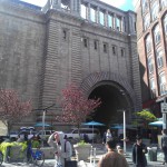
The location I chose for my second project is called Dumbo.The name of this location comes from the acronym “District Under the Manhattan Bridge Overpass”. On September 25th, I decided to take a well needed walk around my campus. I started by walking out of Namm Hall and started walking up Jay Street. I walked bass Tillary St and continued walking. Along the way, I saw the entrance to the Midway Building and as I continued walked I arrived in front of the Voorhees Building. Around this general area is where the Manhattan Bridge starts. I walked under the beginning of the bridge then walked under an overpass. The next thing I know, I was standing in from of a guide map that explained the area in which I just entered. It was Dumbo and it looked very interesting. It was a modern area where modern building architecture clashed with Old Brooklyn architecture. I would go more in depth but I’ll save that for the essay!

“You start building your private New York the first time you lay eyes on it”. – The Colossus of New York by Colson Whitehead
Even though I’ve been building my private New York since I arrived here back in ’00, I’ve still to explore thousands of areas around it!
Dumbo proves my case because I’ve never been to such area before. Usually, I’m use to being around houses and apt buildings but living right next to a bridge and the ocean water is something entirely new to me. This quote will be reflected in my writing in the sense that I’ll be describing some of the features that make Dumbo entirely new to me and how small windows of past Brooklyn accent the modern parts.

“Yet, as I came to understand the place where mentoring, criticism , and producing overlapped, I moved into the sphere more gracefully than I’d ever imagined”.- Fort Greene Dreams by Nelson George.
Dumbo is a mixture of a residential and commercial area. It has bars, clothing stores, an art gallery, a bank, event areas and other small stores. You can do a lot of activities in this area so it would come to no surprise that a lot of age groups over lap in this area. In my essay, I’ll be writing how this location has changed from a manufacturing district to a habitable area.

Homework from class on 9/18

For homework, write a summary of “City Limits” in a blog post. That means it should be roughly 250 words. Use the handout on writing a summary to help you decide what belongs in your summary and what does not. Choose the category “Homework” and add any tags you think are appropriate for your post. Also choose the tag for your group–I’ve added them all for this post, so you can just choose it from the list of tags. Publish your post by the end of the day on Friday.

Before class on Monday, comment briefly on the summaries of each of your groupmates. You can find them easily by clicking the tag on the right-hand sidebar of our site. Your comments might include suggestions to improve the summary, aspects of the summary that you would like to incorporate into your own summary, comments about the style of the writing, or questions you have about something they’ve included. Remember that we want comments to be encouraging, and that any comments should be respectful and helpful.

Additionally, you must revise Project #1 based on the comments I made in class and in my letter to you.

I look forward to reading your work!