1-What is the map’s call number?
NYC- [1921?] F1
2-What is the map’s title (if available)?
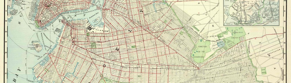
“Brooklyn Heights”
3-Which collection does the map belong to?
Flat Maps Collection.
4-When was it made?
It was made in 1921.
Physical description of the map:
5-What size is the map (approximately)?
It was about 12×8 inches
6-What colors does it use?
The key had two colors to differentiate both lines on the transit but the actual drawing consisted of black and white colors.
7-What materials were used to make the map?
The materials used in making this map is paper and ink.
8-Who made the map?
The creator of this make is Ohman Map C.O. HB Peterson.
Map content:
9-What location does the map depict?
The location that this map depicts is Downtown Manhattan and Brooklyn Heights.
10-What details does it include?
This map includes a legend, a title, street with names, transit lines, bridges, a river, and name of certain areas.
11-What time period does the map depict?
This map depicts the time period of the 1920’s.
Is this the same as the time when it was made?
Yes. It looks very old and the age seems to correlate with the time its depicting.
12-What is familiar to you about the location depicted in the map?
It reminds me of todays subway map because it shows transit lines in the city that go into Brooklyn. It also shows downtown Manhattan, Brooklyn Heights, and part of Downtown Brooklyn.
Interpretation and Reflection:
13-What is the purpose of the map?
The purpose of this map is to show transit lines that go into Brooklyn Heights.
14-Why did it survive prior to becoming part of the archives at BHS?
It may have been kept well preserved by the creator and eventually made its way into the hands of collectors.
15-Why did BHS incorporate it into its collections?
Brooklyn Historical Society serves to preserve original documents that hold Brooklyn’s rich history. This map is a prime example of a small hint of how Brooklyn was like back in the 1920’s.
16-What is familiar or unfamiliar about the map?
Some of the train stations seem a bit unfamiliar to me, along with some of the street names. Also, I didn’t know that there were only two train lines running back then.
17-What additional information would you want to better understand the map?
I would like a picture of the whole subway map so I would get a better understanding of the transit lines.
18-Where is City Tech in relation to this map?
City Tech is located in what would be modern day Jay St in Downtown Brooklyn.

