Summary For SPE

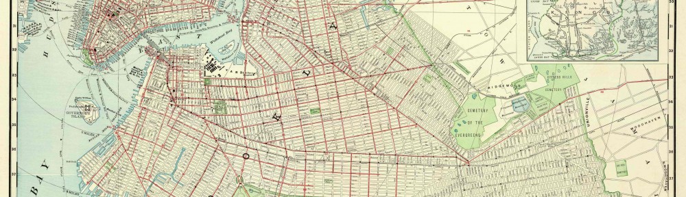
On Tuesday October 15, 2013 we went to the Brooklyn historical Society. While in the Brooklyn Historical Society we were given clear instructions on how to handle the maps because they were very delicate, that we were to point on the maps with our finger not with a pencil, not to hold up the maps, we were asked to leave our bag packs in a small place to avoid any undesired disasters, and lastly to treat the materials with respect. Groups were asked to look at maps that depicted how Brooklyn looked in the past, we also had to answer some questions about those maps in a handout that was given to us. Right towards the end of class Prof. Davis surprised us with an announcement, he stated that we were to create a speech based on the maps and that we had about 15 minutes to do it, the speeches overall were great and were presented professionally to the audience. In the end we heard some feedback from both Prof. Davis and Prof. Rosen that help us become better speakers and departed from there.

Official Map and Guide of the Brooklyn Elevated Railroad from the BHS

20131015_130601

Official Map and guide of the Brooklyn elevated Railroad, 1885

Flat map B C-1885a.FI

Brooklyn Historical Society


1-What is the map’s call number?

BC-1885a.Fl

2-What is the map’s title (if available)?

official map and guide of the Brooklyn elevate reailroad
3-Which collection does the map belong to?

it belong to the fllat Map, the elevated railroad train collection.

4-When was it made?

1885

Physical description of the map:
5-What size is the map (approximately)?

11x 15 inches

6-What colors does it use?

it use red, black,and tan

7-What materials were used to make the map?

it used paper, ink to make the map
8-Who made the map?

J.W.W.Mitchell made the map

Map content:
9-What location does the map depict?

it depicts Downtown Brooklyn,Willamsburg, Navy Yard…

10-What details does it include?

it include the east river, the name of each street, train stops, time table.
11-What time period does the map depict? Is this the same as the time when it was made?

it depicts late 19th century Brooklyn railroad, and it does reflect the time when it was made.
12-What is familiar to you about the location depicted in the map?

Some of the streets like Fulton street, Jay street and the east river are familiar .

Interpretation and Reflection:
13-What is the purpose of the map?

It is a guide to Brooklyn elevated railroad.
14-Why did it survive prior to becoming part of the archives at BHS?

it survives prior to becoming part of the archives at BHS because it was an important map of its time. it shows the transportation at that time of period.
15-Why did BHS incorporate it into its collections?

because it include a lot of details, show the downtown Brooklyn and its elevated railroad in the past, it is a very important history that people study history should know; and is in good condition.
16-What is familiar or unfamiliar about the map?

some of the train stops are still here today, it is familiar, but some streets like Pearl Street are changed, the structures are not the same as in the 19th century.
17-What additional information would you want to better understand the map?

I want to know what is the time table? why it is on the map
18-Where is City Tech in relation to this map?

it is on the western part of the map.

Maps At The Brooklyn Historical Society- Map Of Brooklyn Heights

1-What is the map’s call number?

The Map’s call number is [18-?] g.FI

2-What is the map’s title (if available)?

The title of the map is map of the Brooklyn heights.

3-Which collection does the map belong to?

The collection that the map belongs to is the Pierre point collection.

4-When was it made? The map was made in the 1800’s.

5-What size is the map (approximately)?

The size of the map is10x15 Inches.

6-What colors does it use?

The colors that the map uses are Tan, Black, and Green.

7-What materials were used to make the map?

The map used paper and ink.

8-Who made the map?

The map does not say who made it.

9-What location does the map depict?

The map depicts Brooklyn Heights.

10-What details does it include?

The map includes details of the street names, and where the east river is located.

11-What time period does the map depict?Is this the same as the time when it was made?

The map depicts Brooklyn Heights in the 1800’s and the map does represent Brooklyn heights at that time.

12-What is familiar to you about the location depicted in the map?

The river, and some of the streets.

13-What is the purpose of the map?

The purpose of the map is to serve as a guide to the area and lands that the Pierre Point’s owned.

14-Why did it survive prior to becoming part of the archives at BHS?

The map survived and became part of the archives at BHS because the family managed to kept their records well.

15-Why did BHS incorporate it into its collections?

BHS incorporate it into their collections because its a map of the area in which the BHS is.

16-What is familiar or unfamiliar about the map?

Some familiar and unfamiliar things about the map are some of the streets.

17-What additional information would you want to better understand the map?

Some of the additional information that I would want to better understand the map is Probably a legend that tells what the color Green means.

18-Where is City Tech in relation to this map?

City Tech is located on the North East of this map.

Working with maps at BHS

Today again our Speech and English class had a field trip where we went to Brooklyn historical society to observe and analyze few maps from the Pierpont family who owned most of the land in Brooklyn back in the days. Each group was assigned 3 maps each to perceive. In my opinion it was quite an amazing experience because it was something new which we did apart from reading text in class, writing summaries etc. When I was working with the maps it made me think more intellectually and analytically. There was a time when I got so much in depth in a map that I really wanted to find out why are those words there? I never thought that I would get an opportunity from the learning community to visit such as place which is phenomenal. By getting an experience on how to read map I think it also taught me that when you are reading something or looking at a particular thing just focus on it. Often people tend to get distracted but one should not and should instead try to be determined in completing that task with full effort. I think resources at BHS are not valued because majority of the people are not aware about the place.  In future, if I get an opportunity to research on a project in my coming semester’s I would definitely use BHS as my resource in my paper.

Map of the Benson & De Beauvios property from BHS

IMG_0687[1]

1-What is the map’s call number?

Pierrepont- 1820(1868). Fl

2-What is the map’s title (if available)?

Map of the Renson and De Beauvios property in Brooklyn belonging to H.B Pierrepont, 1868

3-Which collection does the map belong to?

Manuscript

4-When was it made?

1820

Physical description of the map:
5-What size is the map (approximately)?

36”

6-What colors does it use?

Purple, Black ink on cream color paper but may be the color changed from white to cream because the map is kept for a long time in BHS.

7-What materials were used to make the map?

Paper, Ink and Ruler

8-Who made the map?

W.C Pierrepont

Map content:
9-What location does the map depict?

Brooklyn Heights

10-What details does it include?

Property of the Pierrepont family during that time.

11-What time period does the map depict? Is this the same as the time when it was made?

1828 and it was published in 1868.
12-What is familiar to you about the location depicted in the map?

It is around our campus.

Interpretation and Reflection:
13-What is the purpose of the map?

To tell the land owned in feet’s and acres by longitude and latitude around Brooklyn.

14-Why did it survive prior to becoming part of the archives at BHS?

It was passed down, the Pierrepont family wanted to keep record of their land.

15-Why did BHS incorporate it into its collections?

Because its ancient and it shows the history of this Neighbourhood location.

16-What is familiar or unfamiliar about the map?

It is near city tech area and also some of the places name have changed and some of the places didn’t even exist anymore.
17-What additional information would you want to better understand the map?

Texture to be a little darker and a legend to understand it effectively.
18-Where is City Tech in relation to this map?

City Tech is not on the map but to our calculations it would be located on the North East side according to the compass in the map.