Library Archive Report #2
Leave a reply
The Robert Moses papers are organized not as a biography of his life. The papers are organized by the series of different projects and campaigns he participated in and benefited in throughout his life, as well as speeches and photographs. These include the Triborough Bridge and Tunnel Authority, Emergency Public Works Commission, and the Long Island State Park Commission, etc. Most of them overlap with each other, showing that he was involved with more than one thing at a time. These documents can be found in the Annex section of the New York Public Library Rare Books and Manuscript Division.
The things that Eamon talks about in this article are relevant to my topic since he is giving information about Irishtown that later on became Vinegar Hill. This source helps on the research of my assignment but doesn’t fill all my needs. The author and the publisher are trusted sources. The author is a dedicated writer and researcher of this neighborhood.
Eamon comes from the Loingsigh family that has witnessed the history of this neighborhood, the changes area’s names, and the tough times that Americans gave to Irish. The currency of the source information is pretty reliable even though it was published nowadays, the content of it was taken by trusted sources like history books and family personal experiences.
Brooklyn Daily Eagle website is up-to-date source since it is dedicated to write the Brooklyn’s history and everything else that has to do with this borough from 1841. Eamon comes from an Irish emigrant family that moved to Irishtown, Brooklyn, New York in 19th century. His parents and grandparents told him stories about Irishtown, he read books about it and did research online. I looked up some of his sources like the book Gotham and I did verify them.
In that part of Brooklyn were known the neighborhoods like Dumbo, Vinegar Hill, Brooklyn Heights and Navy Yard, but Irishtown wasn’t recognized as an actual place in official records. This made the author to write about it. Creating this source came down to his family, they told him stories about Irishtown. Nobody knew much about it at that time since the computers and internet didn’t exist, so it wasn’t easy to look things up.
The name WikiGalaxy is beautifully given to the site and that is very true. I always end up clicking one of those blue highlighted words/links and like many of us I become dependent of the Rabbit Holes. The latest that I was captivated by the Rabbit Hole was when I was reading about Vinegar Hill and Brooklyn. I kept clicking on the highlighted words and it took me by surprise somewhere completely different from what I was supposed to be focused on. So that’s the funny part, that for that first assignment it took me a lot more time then the two preceding assignments combined. The time was longer but worth it since I got to learn stuff that I never heard before or stuff that I always wanted to read about. So my conclusion is that if you have a deadline you should force yourself not to be prey of Rabbit Hole, otherwise open your horizon by clicking those links that interest you.
Based on the reading I noticed that Brooklyn distilleries issue was very important to the merchants of vinegar hill and to the government as well. This caused several wars between them when the government raised their taxes, closed and destroyed their illegal activities. The corruption somehow always finds the way through by bribing revenue officials and infiltrating into the government institutions. Even nowadays this corrupted activities still exist but they are very well hidden from the public, and people find out about this stuff after centuries in history books. This issue became harder to get rid of after the Brooklyn distilleries expanded a lot and became a huge method of income. After the distilleries stopped completely their activity vinegar factories popped up, and maybe that’s why the area got the name Vinegar Hill since it is located in a hill as well.
This article definitely gives you an appreciation for the growth of technology. The birth of the Geographic Information System (GIS) has been a tremendous help in urban planning and design. There’s so much one can accomplish by using this amazing technology. It allows one to gather data from different sources to get all types of work done. I must admit I have never heard about GIS before reading this article nor did I know what GIS meant. This article has given me a better understanding of GIS and the types of companies that benefit the most from using it. Research institutions, environmental scientists, health organizations, land use planners, businesses, and government agencies uses GIS to develop and enrich our communities making it a better and safe environment for everyone.
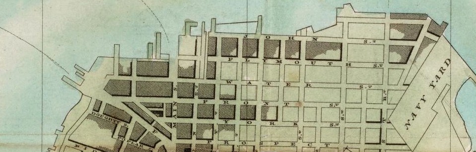
I discovered during 1776- 1820 in Vinegar Hill there was not much technology available in the community. During those time people found it difficult to create and construct new projects for the community such as buildings, schools, and parks. There were no resources or equipment available to store or save materials and documents such as blueprint of buildings and important government documents. It was very hard to capture things because people did not have the proper writing materials and resources to grasp the view and different scenario that was happening during that time. However, I found out what people did to compensate for their lack of resources was drew on maps in specific areas to store important information. These maps were very few and limited because they did not have the technology to duplicate them.
The information we were unable to capture was the farm plot shown on the old maps. We will be able to access these documents by visiting the library archives and requesting the specific documents or though the internet where it is more easy and convenient. Other information that was not available to view was the State Documents that show the development of Urban Renewal and the people who started it. I believe the reason these document were not available is because they got damage or destroyed over a period of time, making it difficult to keep together and display in the library archives or posted on the internet.
When reading the handout on geographic information system, I found that the section discussing the use of GIS during urban planning to be very interesting. GIS is an essential tool in sustainable development. This is especially true in urban areas where there is a steady increase in population. I think the practicality of GIS technology is vast and will continue to evolve as other forms of technology change. I like that there is a lot of positivity that comes from using GIS during urban planning. It allows developers to use empirical data to determine a healthy, optimum area to create cities. Because of this, the people who will move into these cities will have the opportunity to experience a higher quality of life as opposed to cities built on any type of land.
Geographical Informational System (GIS) as a tool for research is now an integral part for many institutions for analyzing and planning architecture, infrastructure, facilities, etc. especially for ensuring conformity to established policies and regulation; however, the GIS technologies available today are still not advanced enough to forecast accurately. The potential for improvements in planning and development of human and environmental interests are still adequate enough to continue to use and improve GIS capabilities and qualities. Also, enabling more user friendly apps will help to permit data to be more efficiently, effectively, and appropriately acquired and discriminated, so not only less than expert GIS users can have access and implementation to this incredible technological resource. The only major concerns now are in the ways that this publically accessible information will be used. Also, there needs to be a cost effective means for verification and confirmation of the accuracy, legitimacy, proper and ethical uses, etc. of the open source GIS technologies. GIS technologies may help in many ways but there are still more complexities and concerns involved/inherent within the use and improvement of GIS technologies. The work load still doesn’t become reduced, but the gain in quality of life and of the environment is priceless. GIS technology is worth the investment of reasonable resources, it is economically and environmentally profitable, and it is worth every effort thus far…
The OpenLab is an open-source, digital platform designed to support teaching and learning at City Tech (New York City College of Technology), and to promote student and faculty engagement in the intellectual and social life of the college community.

