LIB 2205 ARCH 2205_SP16_ALMEIDA-MONTGOMERY_AISEL-OMERBASHI_FINAL
Learning Places – Final Project
Leave a reply
Link to shared files: https://github.com/coderhub/Brooklyn_1827
Created By: Carlos Merced
Date: May 25, 2016
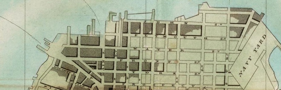
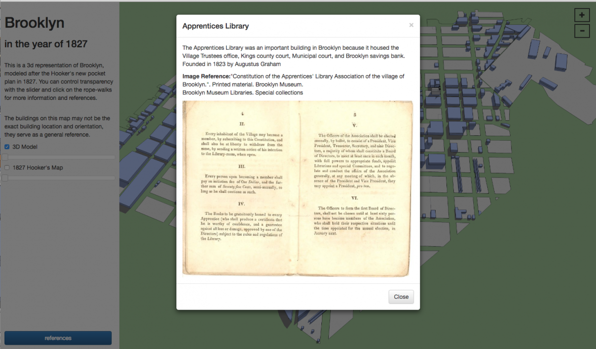
Title: Brooklyn in the year of 1827
** Works in Firefox and Google Chrome updated browsers **
This 3d model of Brooklyn shows the land occupied or sold in 1827, along with rope walks and other building data. The blue represents occupied space and the tan color represents undeveloped or unsold land plots.
Click on index.html to view the interactive map. 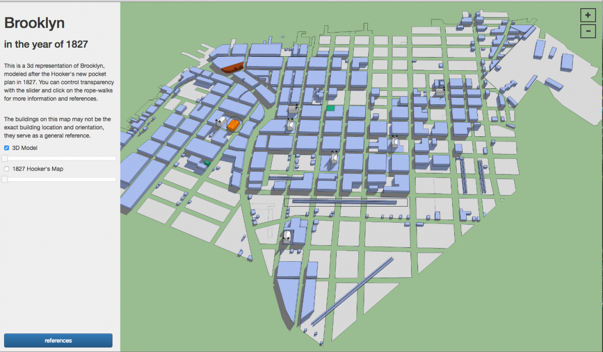
Hello everyone! This is the link our Open Lab Page for our final project, if you haven’t already, please join!
(Project Page) https://openlab.citytech.cuny.edu/groups/vinegar-hill-spring-2016-project-site/
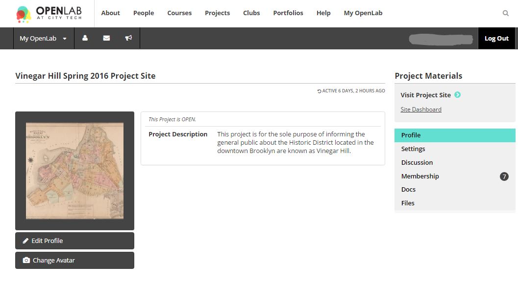
(Project Site) https://openlab.citytech.cuny.edu/vinegarhillspring2016/
Deliverables: I will be constructing a report/summary (Presentation Material) of the information from my research of the demographics, politics, and urban renewal of the 1920s thru the 1960s (Scope), which may be presented as a PowerPoint/Prezi Presentation, and/or documentation report, and/or project, and/or technological media on a consolidated platform such as OpenLab, CartoDb, SketchUp, Wikipedia, YouTube, etc. I will be able to determine the most appropriate platform once my project is in the final stages. I will also coordinate my research with a classmate since we are focusing on similar aspects of my research project. His consolidation platform would be my main consideration towards my research contribution.
Report/Summary Construction Process: I will be using and consolidating the information from the resources from my research, such as libraries (books), web searches (“dot-gov” and articles), archives (historical maps/documents). The main consolidation of information will be taken from my previous reports and bibliography. I will combine and focus information regarding demographics, politics, and urban renewal to produce a final project geared towards a sociological (social sciences) approach.
Research Gaps: Although there is information regarding the demographics, politics, and urban renewal of the 1920s thru the 1960s, there has been limited information about the causes for the landscape cutoff point at Hudson Avenue and York Street.
Evolution of My Project: My project has changed/morphed from a focus of the cause of a physical aspect (landscape) of a street (Hudson Avenue) into a more sociological focus of the demographics and politics involved in the urban renewal of the 1920s thru the 1960s.
Throughout the semester the focus of my research has been on how the Brooklyn Bridge and Manhattan Bridge affected the vitality of Vinegar Hill. After my research at the libraries, archives, and online, I have obtained a lot of information regarding the Brooklyn Bridge. However, I have not found a lot of information on how the Manhattan Bridge changed Vinegar Hill. Because of this, I think that the focus of my final will be predominantly on the Brooklyn Bridge. My scope is wide in the sense that I am focusing on multiple factors that involves the Brooklyn Bridge. Some factors include but are not limited to the following: population change, public perception, why the Brooklyn Bridge was built, its effects on transportation, and how the bridge changed the ferry industry, if at all. In addition, I am toying with the idea of delving into the actual construction of the Brooklyn Bridge.
I think that the best way to produce my research in a final project is in written form. I would like to post my final project on OpenLab as a page dedicated to the Brooklyn Bridge. As of now I am researching and writing independently. Even though my work is independent, I want to contribute to the project page that is being set up by a fellow classmate for the entire class to post on.
The OpenLab is an open-source, digital platform designed to support teaching and learning at City Tech (New York City College of Technology), and to promote student and faculty engagement in the intellectual and social life of the college community.

