https://catalog.archives.gov/id/6880436
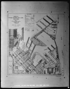
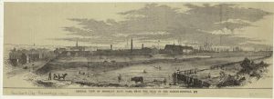
I choose this piece of work because it gives a clear plan on how the Brooklyn Navy Yard was designed. The topic of this picture is the general plan of the Navy Yard. The plan shows the Navy Yard showing roads, buildings and docks. It was created on June 30 1906. The creator of this photo is Department of the Navy. Bureau of Yards and Docks. New York (Brooklyn) Navy Yard. 1862-9/18/1947. This photo is from Series: Photographs of the Construction and Repair of Buildings, Facilities, and Vessels at the New York Navy Yard, 1903 – 1920. Record Group 181: Records of Naval Districts and Shore Establishments, 1784 – 2000. It fits in with my topic because it gives a plan of how the yard was laid out and it could be compared to a modern-day plan of the Brooklyn Navy Yard. I could try and see what buildings still exist in the Navy Yard. The question that comes up is who created this plan and why did they choose this format. To answer this question, I would try to find a more detail plan with an explanation.

 link to image

