Category Archives: Reflection

NYPL post site-vist reflection

4

It was fascinating to see the meticulous work that went into marking each detail of the Sanborn fire insurance maps. A typical person looking at the maps would not be able to effectively dissect the different components. Myself included has only scratched the surface of each map, from the maps dating back to 1800’s to 1929 to the most recent maps presented, 1950’s.

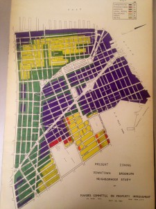
One of the most significant piece of document that stuck out to me was the Downtown Brooklyn Neighborhood Study by the Mayor’s Committee on Property Improvement. The text and maps shown throughout the book studies the current conditions in the 1940’s when the study was conducted to the potential and outlook the mayor committee had on the area. There were four areas of focus that were adaptable to re-planning and reconstruction under the urban redevelopment corporation act.

Aside from educational purposes, The Lionel Pincus and Princess Firyal Map is a valuable source of information readily available for anyone for personal interest- as long as we are willing to look, information is there.

Daiane Bushey | NYPL Post Site Visit Reflection

Our visit to the New York Public Library was really instructive because it put all the students in contact with physical maps of the Vinegar Hill area. (Before, we were mainly looking on digital versions of maps of that region). We had access to entire books of maps so, Ā just by flipping a couple of pages, Ā we also saw many maps from adjacent areas and maps from different decades. It was interesting to learn that those map books used to be updated just by gluing paper with the new information on top of the old maps. Also, it was really fun checking Google Maps and Ā contrasting it with the books,Ā comparing what was like in the past and how it is right now.

NYPL Post Site Visit Reflection

Our visit to the NYPL turned out even better than i expected. Like i said in the pre-site reflection, I have never been to a library bigger than the one at City Tech. The amount of information I was able to collect in that one hour was amazing. My research topic is the built environment of the area, specifically what was there before the Farragut Houses. In the one map book alone, I was able to record with great detail what each building was at the site in 1941. These maps also told us what the buildings were made of, and if there were any commercial spaces in the building. This was exactly what we needed, since the demolition of this area occurred only a few years later. I hope to have the opportunity to go back to the NYPL and look at other maps and resources to further help our research.

Pre-visit Library

Based on some of the other posts I read i’m not the only one that hasn’t been to the library in a while, and not just to use the bathroom but to actually research something. I think this should be a good visit, although we’ve visited the site and collected data on it, one of the best ways to find out the “why” of something is to look at its history. If we can see the conditions of the land or what was there before, we may be able to draw conclusions on the thought processes of those who decided to be rid of a “slum” to make way for this construction. I think this information should be beneficial to all groups

Urban design Reflection

This visit was well worth the short trip to the Voorhees building. Our class did plenty of research on the Farragut houses and it’s surrounding areas, documenting our finding on its safety, crime, demographics and so on. It was interesting to see another class who did similar research and used said research to devise a way to better the community. All three groups that presented their findings and solutions to use recognized the desolate nature of the area and realized that focusing on correcting that was key. Some ideas were to try to up the safety factor of the area with wider streets and shorter blocks and to add more commerce buildings, and some wanted to diversify the area into multiple forms of Commerce and residential buildings to try and create an atmosphere of camaraderie amongst community members. I thought all the presentations were well thought out and interesting

Post-reflection Urban Design Studio

Monday’s class visit to the 4th year architecture studio was insightful and impactful It was a great to have the two classes come together to share different projects within a similar topic. I would love to have more opportunities for co-learning environments like this.

A couple interesting pointers:

Professor Duddy pointed out a brilliant idea for additional future collaborations between the two sets of students. What if all the research the students from the ‘Learning places’ course collected of the history to the demographic to the real estate factors of the Farragut Housing from this semester with is shared with next semester’s architecture students who will work on creating a master plan for the area around Farragut Housing, wouldn’t the exchange of information there be extremely helpful in adding to the architecture students’ designs.

Another interesting finding were the solar sun path diagrams one group included in their master plan. They included the Sun’s path it travels from East to West throughout the day and how that factors into where specific buildings are positioned and the type of design to the type of material used for the design. This ties back to what we learned about in our site-visit: sun patterns was one of the reasons behind the architects’ intent when designing the Farragut Housing complex’s star-like shape.

What is most rewarding about interactive learning is regardless of what disciplinary study anyone may be in- how similar or different, we can all take away something new each time when information and ideas are shared. I have definitely gained new perspectives since day one and now I am starting to “see” what seems as everyday objects in an more analytical manner.

Urban Design Studio Visit Reflection

I thought the visit to the students of the Urban Design Studio was very interesting and informative. Seeing the different ways that the NYCHA grounds at the Farragut Houses can be better utilized, was an eye opener. I really liked aspects of each teams ideas, in what I would think would be an improvement to the area.

Pre Site Visit Reflection

I am very excited to visit the NYPL in Manhattan tomorrow. I have never been to this library, or any library in the city as of yet. I have also never been able to study historic maps in person. My groups research topic is built environment, so these maps will greatly help our research.

In regards to the reading “Unbinding the Atlas:..” I thought it was very interesting. I completely agree with what all of these institutions are doing through these programs to digitize these historic maps. Many people do not live close to a library like the NYPL (like myself) and having these digitized maps make it easier to do research. Also, digitizing mops makes it possible to search databases, where you would have to look through countless maps in person to find what you are looking for. Again, these digitized maps make research much easier.

per-visit reflection of NYPL

I am looking forward to Visit the NYPL map room and the library in general since I have never been there and I think will be a great learning experience . I think the idea of focusing on old maps to figure out what was on the piece of land where the Farragut houses were built is a very brilliant idea. Although everything is online and digitized many people would not see the purpose of visiting a library map room but like Professor Mogommery mentioned when you have something in front of you it is important to block everything out of your head that you may be thinking about before and just focus on what’s in front of you to see what’s there to discover and appreciate the preservation of history. I imagine the library to be a very busy touristic place with a lot of people going inĀ and out.Ā I personally, always enjoy spending time in a library because it is always very peaceful and quiet and it allows me to refocus in order to finish any school work I may still have pending. In addition this visit will also allow us to access maps that may not be found online since they may be very old and fragile. Lastly in the article, ” Unbinding the Atlas; Moving the NYPL map collection beyond digitization” it basically speaks of how maps go to the web as scanning images which makes it easier forĀ information seekers to share the common desire to better understand a place through time and space as represented on a mapĀ  and as a result most map libraries are converting their map collection into a digital world to make it more time consuming and accessible to the public and people who share common desires to discover places.