Category Archives: Professor

Preparing for our visit to the New-York Historical Society on Wednesday 3/29

This Wednesday we are scheduled to visit the library of the New-York Historical Society. Please arrive on time at 1:30 to allow time to check your coats and bags. Our research visit begins promptly at 1:45. The N-YHS is located at 170 Central Park West at W. 77th Street (B/C trains to 81st Street; 1 train to 79th Street).

Before our visit, please read the short blog post How to Make the Most of your Trip to the Archive from the blog Librarian Shipwreck, especially section #2 that describes Finding Aids.

Site report #4 (NYPL Map Division) is due on Thursday, March 30.

NYPL map division wrap-up and preparing for next week

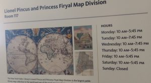
The Map Division is open 6 days a week to the public – and YOU – for further research

We visited the NYPL map division on Wednesday and topic groups studied maps to find evidence for hypotheses. Site report #4, based on the NYPL visit, is due on Thursday, March 30; use the template for #3, and be sure to save it as a reduced size PDF to upload to our course site when you’re ready to submit it.

Looking ahead to next week: on Monday, come prepared to discuss the visit to the Map Division. We’ll also discuss quantitative data sources for research.

On Wednesday, March 29 we visit the library of the New-York Historical Society, Central Park West at 77th Street in Manhattan (B or C trains to 72nd Street; 1, 2, 3 trains to 72nd Street). Our research visit begins at 1:45 sharp, so please plan on arriving by 1:30 to register and check your coats and bags. Please review visitor information and policies in advance of our visit.

Review of Monday 3/20 and preparing for NYPL Map Division trip on Wednesday 3/22

Today we discussed the complexities of maps and representations of geographic and spatial data. Consider these questions: How does geographic information address your group’s hypothesis, or how could information from a map lead you to a solution? What are some potential “lies” or omissions you might encounter when consulting historical maps?

We reviewed the Map Warper, a tool that allows anyone to georectify historical maps over a contemporary street grid. On Wednesday, we meet at the New York Public Library, Map Division. Enter the library at 5th Avenue & 42nd Street. Go up the large central staircase to the second floor. We meet at 1:45 SHARP in room 216. We’re meeting at the main research library, called the Schwarzman Building, at 476 Fifth Avenue at 42nd Street. If you see Patience and Fortitude, you’re good!

Before Wednesday, please read About the Map Division from the NYPL website. Remember, site report #3 is due on Wednesday by the start of class.

Review of today, and readings for Monday, March 20

Today we used bubbl.us to visualize hypotheses and related data that support them, including primary and secondary sources. Please bring your mind maps to class on Monday — on your phone is OK. We spent some time reviewing the principles of one-point perspective drawing and practiced sketching the frame, vanishing point, and horizon line to sketch our classroom — and added windows and doors to the room. We then turned the basic sketch into a street scene.

On Monday, March 20 we’ll explore historical maps, and we’ll visit the map division of the New York Public Library on March 22. Please read the following:

Historic Maps as Historian’s Evidence (also the Mapping and Political Power section)
Making Sense of Maps (especially these sections: What is a Map? Where do I begin? Who Made this Map and Why? and How is the data Organized?)

Site report #3 is due on Wednesday, March 22 by the beginning of class (template here). A revised schedule for the rest of the semester’s class meetings can be found here and on the Syllabus page.

Brooklyn Collection and Site report #3 (due 3/22)

On Monday we visited the Brooklyn Collection at the Brooklyn Public Library to examine newspaper articles, photographs, books, historic fire insurance maps, and more. We had a quick introduction to various digitized collections that you can search from home, including city directories, historic photographs, and the Brooklyn Daily Eagle. If you missed the class visit, you must visit on your own. Be sure to take photos and document primary sources you find that are relevant to your group’s hypotheses.

Site report #3 is due by the start of class on Wednesday, March 22. Download the template, save with a new filename that includes your last name, and when you’ve completed it, save as a reduced file size PDF and upload to our OpenLab course site.

Monday, March 13 – sketches and Brooklyn Public Library

On Wednesday we spent some time “turning off our brains” while sketching from upside down paintings. Turning the painting upside down helps us overcome preconceived ideas about what we see. We also looked at Javier’s post comparing contemporary and historic street scenes in Jackson Heights and discussed what makes the contemporary scene more pleasant and how we could draw analytical sketches which emphasize particular aspects in the scene such as shadows, windows, trees, etc.

For Wednesday, revisit Javier’s post. Draw 2-3 sketches from each image in the post (they can be quick sketches) – in each sketch emphasize one particular aspect of the scene that you find significant for the discussion. Bring the sketches to class on Wednesday. Be sure to keep all of your sketches together.

On Monday, we’re visiting the Brooklyn Collection at the Central library of the Brooklyn Public Library, Central Library at Grand Army Plaza (directions). We’ll meet at 1:15 in the lobby. Our appointment with the librarian begins at 1:30 sharp. The Brooklyn Collection is on the 2nd floor of the library. Groups will have time to research and begin to fulfill the research objectives you came up with in class. Be sure to bring the research objectives, as well as your charged phone or camera, something to take notes with, your sketchbook and pencils, and a USB drive if you wish to scan anything from the collection.

Don’t forget! The Wikipedia Art+Feminism edit-a-thon is happening all over the world starting today! New York City events include one on Saturday 10-5 at the Museum of Modern Art, 11 W. 53rd Street in Manhattan and one on Sunday from 2-6 at Interference Archive, 131 8th Street in Brooklyn. Come help improve Wikipedia, no experience necessary!

Blogging the archives – assignment due Wednesday, March 8

Regular blogging on the course OpenLab site is part of your class participation grade. Please review the blogging guidelines or get in touch with your instructors with any questions. For Wednesday, please complete the activity described below and write one blog post of approximately 100 words in response to the questions that follow.

Activity: Using one of the digital archives websites we reviewed in class (NYPL.orgdp.la, brooklynhistory.org), do a keyword search to locate a digitized primary source that is relevant to your topic. In your blog post, provide a link to the item you choose and address the questions below.

Blogging questions: Identify the topic, theme, or purpose of the source you chose. Hypothesize about its origins, purpose, and how others have interpreted it or responded to it. How does it fit in with the topic you have chosen to research? What questions does this source raise? Where would you look for the answers?

Looking ahead to next Monday, March 13, please be prepared to meet at 1:30 SHARP at the Brooklyn Public Library, Central Library at Grand Army Plaza. Our class meeting takes place in the Brooklyn Collection on the second floor of the library. Please review the website of the Brooklyn Collection before class on Wednesday 3/8.

WAC Workshop for Students 03/07

WAC (Writing Across the Curriculum) is hosting a workshop for students on Tuesday, March 7, 2017, from 1:00-2:15 in Namm 1006. They will review and help students to understand the importance of the College’s Academic Integrity policy, provide strategies for ethical and effective paraphrasing, and discuss proper citation methods. All students, faculty, and staff are welcome!! No RSVP required; 


Place-based research recap, and readings for Monday 3/6

Today we learned about zoning in New York City and explored the zoning resolution text and maps.  Review selected pages from the zoning handbook that explain districts and define terms and use groups. We also explored OASISNYC.net, a portal for map-based research on New York’s land use, buildings, infrastructure, community data, and much more.

For Monday, please read through the following two websites:

Digital Archives Materials
What are archives and how do they differ from libraries?

Don’t forget! Site report #2 is due by 5 pm this Friday, March 3. Download and save a copy of the site report template, give it a new filename, complete the report, and upload as a reduced file size PDF. See instructions from a previous post.

Preparing for Wednesday, March 1

Site report #2 is due, posted to the OpenLab, on Friday, March 3 by 5pm. Make a copy of the site report template, complete the document with your own text and images, save as a reduced size PDF, and upload to the OpenLab course site, as you did with site report #1.

This site report includes a map. You can edit the map by opening it as a drawing in google, then use the line and shape tools and word art or text boxes to edit and annotate the map (help here). Use Snagit or your favorite image editing software if you prefer. It is fine to print out the map, draw and annotate it, and then scan and paste it into your report.

On Wednesday, we’ll discuss how to use the internet for place-based research, including real estate and buildings research. Please review the guide to primary, secondary, tertiary sources and also take a look at the place-based research guide.