All posts by Prof. Paul King
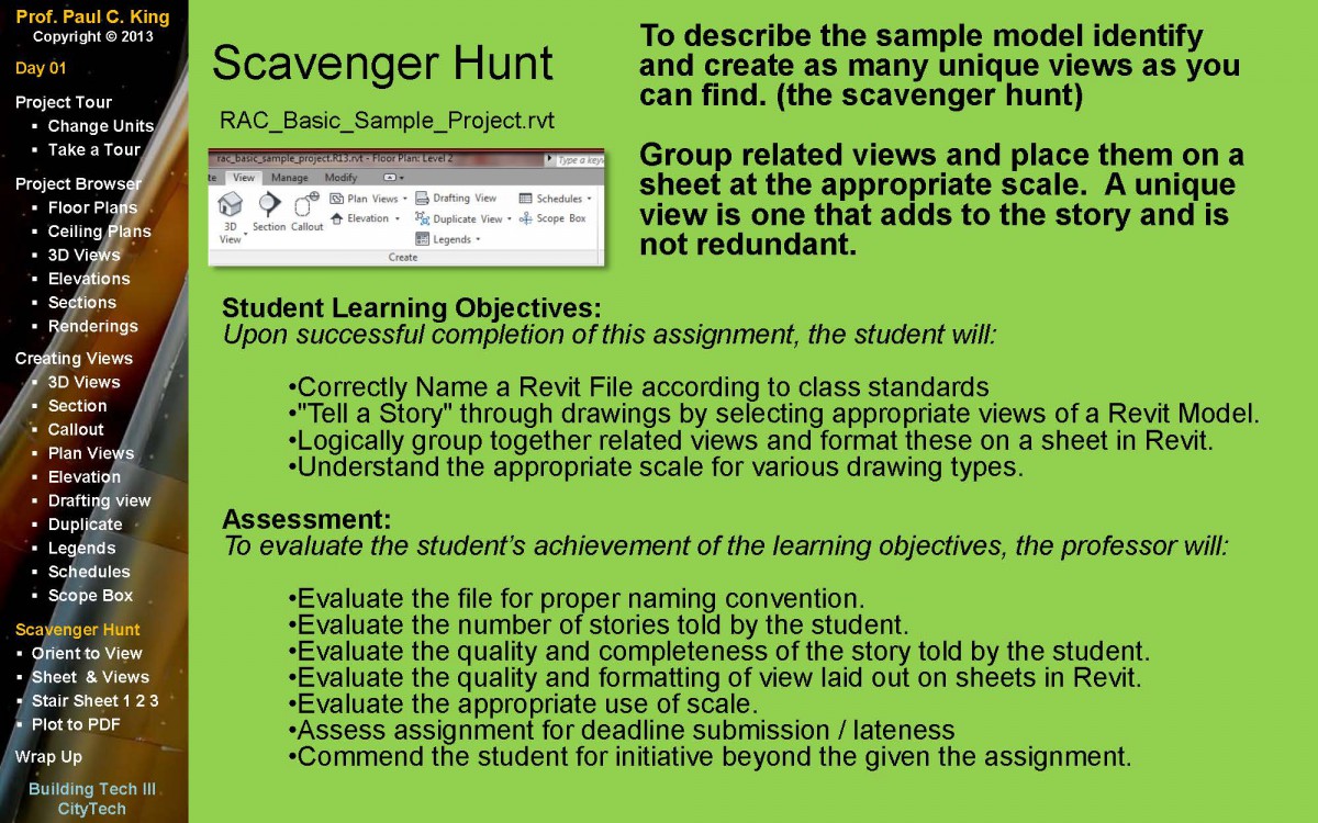
Scavenger Hunt Assignment
To clarify, you are using the file we worked with in class to complete this assignment. A copy of the file can be downloaded from openlab. We will plot the file to PDF at the start of our next class meeting.
follow this link and look for day 10 – follow instructions carefully
Bring Clay to Class
Try to sculpt your zoning envelope.
Quick Writing Assignment
Several teams in both classes are working on the following two sites:
219 JAY STREET, BROOKLYN 11201 (Block: 118 Lot: 1
146 CONCORD STREET, BROOKLYN 11201 (Block: 118 Lot: 6)
There is a proposal to cut of a piece of the large lot and add it to the smaller lot.
- Each team – (including those not doing these sites) must write a short paragraph that argues why the zoning change should be granted.
- As a second part of this assignment consider what images you might want to show at the community board meeting to support your argument.
Presentation Clarification
There seems to have been some miscommunication on what is due for the PowerPoint Presentation – For this presentation you are presenting as a team.
The list of more detailed zoning that is listed on a 22 x 34 sheet will be due next week – by individuals and will be uploaded to blackboard.
Hope that clarifies it.
Please Complete the Following Survey by Wednesday
Upcoming Presentation Outline
Some clarification on the upcoming team presentations:
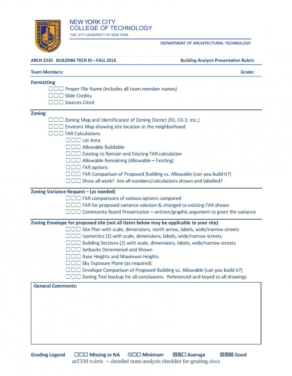
- Zoning Presentation (on 22 x 34 Titleblocks in Autocad) – Teams are permitted to share information but not drawings. Each student must draw their own zoning sheets, graphics and backup zoning text. Each of you will upload your zoning to blackboard.
- Graphic Sheets
-
- Block and Lot, Use Group, etc. C6-2 etc.
- Lot Area and FAR Calculation for allowable Square foot
- Area calculation for the proposed building. Do you have enough allowable sq foot to build it? Do you have extra?Site information and FAR Calculations
- Lot Area
- FAR
- Lot Area x FAR = Maximum Allowable
- subtract Existing Buildings Sq ft to Remain (if any). If none say 0 – but do not leave this out!
- Avaiable Builable is the result
- Environs Map (Neighborhood) – suggest that this sheet matche the limits of your inventory/analysis sheets
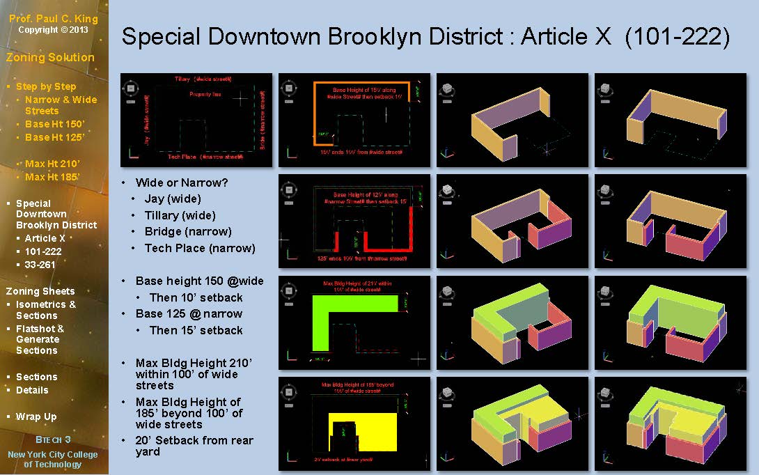
- Site Plan showing zoning envelope from above, street names and narrow or wide status, w/dimensions
- Zoning Map 12D
- 3D Isometrics of Zoning Envelope (2 views minimum) w/ dimensions
- 2D sections of zoning envelope (2 views minimum) w/ dimensions
- Zoning and New Building Overlay – show at least 1 isometric view that shows if the proposed building fits inside your zoning envelope
-
- Zoning Text Sheets – all conclusions must be backed up by zoning text
- Zoning Definitions Sheet – optional sheet for extra credit includes relevant Zoning Definitions for example #wide street# – etc.
- Graphic Sheets
PowerPoint Presentation (Group)
- Zoning – show the following here as well
- Summary of site information – Zoning group/use/site area/FAR
- FAR Calculations as well as calculations of the sq foot of the proposed building to determine if it is within the allowable
- Zoning Envelope, Site Plan, Sections and Isometrics w/ Dimensions
- Structural
- Grid Organization – Show structural solution overlaid on floor plan. You must include spans sizes.
- Floor to Floor – show floor to floors in section
- Mechanical Solution – On a floor plan and a section show where the mechanical room will be, show the location of shafts and the distribution of mechanical systems in section.
- Occupancy – Show occupancy calculations for each room and floor. Use these to determine the required number of stairs and the required width in inches of the doors and stairs
- Egress – Show egress in plan and section. Show stair locations, exists, corridors & direction of door swings (using an arrow line) Include proper size for a typical stair in both plan and section.
- Inventory and Analysis (part of PowerPoint presentation)
Include this item just before your research list. Use a uniform base map. These are graphic not drafted presentations. You can combine categories below if you can make them readable. Otherwise each one should be a separate sheet.- See Inventory/Analysis Assignment
- Land Use/Open Space/Zoning
- Circulation
- Noise
- Geology/Hydrology
- Vegetation
- Climate/Microclimate
- History
- Case Study / Research List – Develop a list of case studies for your team. For each item on the list show a sample image for example – each team must complete a case study of their building type. Select the building you will study now and show us a photo. For each of the other items on the case study /research list show a photo or a graphic of what you intend to research. For this future work please show how the team will divide up the work.
Zoning Answers Tutorial has been posted
3D Massing Assignment
At the suggestion of one of the groups I am modifying this assignment. Please make an attempt to model your design project in AutoCAD. Keep it simple, it’s just a massing model.
Look to follow the steps of the FLATSHOT handout but always using the value 1,1,1 instead of 1,2,3. So all the numbers are 1 and this will give us a 30/60 Isometric model.
Please keep a copy of your drawing before you use the Boolean commands so we can practice together.


