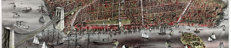
At first I didn’t really think that people studied maps.Maps no longer seem to have so much importance.Now a days a map can be found in any train station or even outside some little truck stand by central park. Seeing some old maps today made me realize how easy we have it with so much technology around us. We can just type an adress on google map and instantly have a picture of it and a virtual look at where the place is located. There’s no need for an index or color coordination, we just type the adress and everything is given. Today’s maps are more specific and they don’t only come in paper but also in a computer, phone or even a gps. In a way I was amazed on how hard someone worked to create a map.It did not only include a place but some even included how deep and ocean was.One can tell by the map how long it really took to be made. Now it’s easier to identify a location because every street has a name and every places identified as Queens,Bronx,Brooklyn, or Manhattan.It probably took a long period of time for someone to create a correct map. Getting around was harder back in the days than what is now.For a map to be made,one probably had to travel around and take notes on what they saw.Through out time it has been easier to make a map.It can be made in the computer instead of hand drawn,and photographs can be used to locate a place.
-

Telling Brooklyn Stories:
English Composition I
ENG 1101, section 5381
Prof Jody R. Rosen
Fall 2011
M/W 1:00-2:15
Office Hours:
M 2:15-3:45
W 2:15-2:45 Behind the scenes
Categories
- Announcements (10)
- Assignments (9)
- Classwork (8)
- Cover Letter (1)
- Homework (4)
- Images (2)
- Instructions (4)
- Juxtapositions (2)
- Maps (3)
- Readings (1)
- Reflections (12)
- Research (2)
- Responses (4)
- Summaries (1)
- Uncategorized (49)
- Walking Tour (3)
- Writing (3)
Tags
- abolitionists
- archives
- B.M.T & I.R.T subway story
- Ben McGrath
- Brooklyn
- Brooklyn Heights
- Brooklyn Historical Society
- City Tech events
- Colson Whitehead
- communication
- drafts
- Essay 2
- Essay 3
- Essay 5
- Essay 6
- finals
- Jennifer Egan
- John Strausbaugh
- language
- learning communities
- libraries
- maps
- Margaret Atwood
- New York
- office hours
- persuasion
- photographs
- poster session
- quizzes
- real estate
- reflections
- research
- revision
- Saul Steinberg
- schools
- slavery
- summary
- support
- surveys
- The New Yorker
- thesis statements
- Truman Capote
- Underground Railroad
- vocabulary
- walking tours
-
Recent Posts
Recent Comments
- valentina on Summary of “On the Trail of Brooklyn’s Underground Railroad”
- Jeff on Essay #6
- Nayum on Summary of “On the Trail of Brooklyn’s Underground Railroad”
- stanleyd15 on Summary of “On the Trail of Brooklyn’s Underground Railroad”
- Account Deleted on Summary of “On the Trail of Brooklyn’s Underground Railroad”
Links
Archives
Meta

