Please reply to this post with a comment, at least 250 words, about your experience at the Brooklyn Historical Society.
Additionally, I’ve put together a survey to learn about your experience. Click here to take the survey to share your thoughts.
Please reply to this post with a comment, at least 250 words, about your experience at the Brooklyn Historical Society.
Additionally, I’ve put together a survey to learn about your experience. Click here to take the survey to share your thoughts.

Telling Brooklyn Stories:
English Composition I
ENG 1101, section 5381
Prof Jody R. Rosen
Fall 2011
M/W 1:00-2:15
Office Hours:
M 2:15-3:45
W 2:15-2:45
The OpenLab is an open-source, digital platform designed to support teaching and learning at City Tech (New York City College of Technology), and to promote student and faculty engagement in the intellectual and social life of the college community.


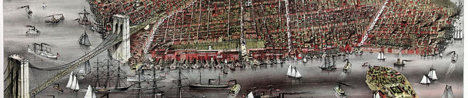
The other day when we all went to the Brooklyn Historical Society Library, all of us had the chance to see different types of map that had been created different historical time periods. After we had seen the maps then we’ve all placed in groups of two and three classmate with different types of map, and compare them with modern world today. I and my partner, we’ve assigned to a map name The heart of Brooklyn (A great shopping amusement). This map was published/drew some point of time in 1940’s, and it shows Atlantic, Fulton, Flatbush, Borough hall, etc represent the map of downtown Brooklyn. Moreover, during that time period the part of that area had a lot of things which have changed over the few decades. For example, it used to have the rail tracks only for B, Q, I, M, T. And where in modern world today shows that there is tracks for 2, 3, 4, 5, B, Q, and R subway tracks. Furthermore, we tried to find the NYC Tech college on the map, but we couldn’t see it. So, as alternative we had used the coordinate lines on the map and decided it belongs in the coordinate of 3 and A because that’s where the Jay st. and Johnson is. Therefore, this small activity had proved that as time passes by so as the change’s occur for many things, and who knows what we are observing today maybe next few years something else may place over.
I made a mistake on the statement where it starts from, “For example…” the statement should be:
“For example, it used to have the rail tracks which the map showed B.M.T and I.R.T, this were the tracks that had been used back in 1904. However, where in modern world today shows that they are replaced by 2, 3, 4, 5 subway tracks.”
For more info you can visit: http://www.nycsubway.org/faq/briefhist.html
The day we went to the Bhs was very different for me being as though i am not from Brooklyn. We got to learn about a lot of different maps throughout the history of Brooklyn. It was interesting to see how many different perspectives of what Brooklyn looked like. Some of the maps were weird the way that they were created, come looked like someone drew and colored it with crayons, another with blocks all over it. What was really strange to me was how the compass on some of the maps, it wasn’t facing the usual way as the maps we see today. As the years past i could see that the maps started to look better and more accurate. Even the subway line on a map was cool because i take the subway to school today and some of the stops were still the same on the train. Ultimately my trip to the Brooklyn Historical Society was an eye opening experience to the history of Brooklyn.
When we went to the library in the Brooklyn Historical Society the other day to learn about map’s, I found it very interesting. First off, I thought the library was really cute because it looked really old fashioned. I found it interesting that the library could not be changed or altered. When the woman was explaining how the maps were made to the class, I found it interesting that the maps were hand drawn and if they wanted color on it they would have to use water colors. (Since printers didn’t exist at the time.) I also found it interesting that they still collect maps of brooklyn today since it will become a piece of history in the future. I also found it interesting that their maps were mostly donations, and that to conserve them they have to keep them in a dark place because light makes them fade. It was also interesting how much each map differed from one another. (Color/detail wise) When we were looking at each of the three maps in our groups, I realized that what is recorded on the maps is different from what is there now. For example, a map that I studied was called “New York Subway elevated lines”. This map showed the subway routes in brooklyn, a bit of queens, and rhode island. This map is from 1942, so the train routes have changed since then. The names of the areas on the map have also changed since then. For example, New York City College of Technology was not built at the time, so it was not on the map. Overall, our trip to the Brooklyn Historical Society was really interesting, and informative.
The day we went to the Brooklyn Historical Society was a very interesting experience to me. Seeing different types of maps and their purposes made me understand that each of these maps tells us a little story of how Brooklyn looked like. Maps back in the days were very expensive to print and not everyone had access to them. This is surprising to me because if I wasn’t from Brooklyn I would not be able to get around without a detailed map. I compared the manuscript and subway maps which was very interesting. The Subway map was printed well designed and detailed, very easy to understand. On the other hand the manuscript map which was created by the Pierrepont family was handmade, not so detailed and hard to understand. This manuscript map made me wonder why this family would create a map. Many thoughts came to my mind such as: they wanted to create a visual map of the land they owned and this will also help if they wanted to buy more land. I am interested in knowing more about Brooklyn’s history and the wealthy family who founded it. I was also amazed by the way the library looked old fashioned and very pretty. Since it is a landmark it can be changed so I got to see how Brooklyn’s libraries would look many years ago. I enjoyed our trip to the Brooklyn Historical society learning about maps and working in groups to hear my classmate’s points of view. I would love to visit again.
The trip to the Brooklyn Historical Society was very interesting. I was amazed at how many different kind of maps there actually is. The older maps that they had there weren’t much how Brooklyn looks like now, but one of the maps really got my attention. I saw that Brooklyn was once all farmland. On this map i also saw that most of downtown Brooklyn and what is now sunset park had the streets on the map and the rest was just drawn as farmland. This got me interested because i live in Bensonhurst and on that map i would be part of the New Utrecht town. It got me thinking, how would i get around Brooklyn in the earlier years where maps weren’t as easy to get as now a days. When maps first started to appear, only the wealthy could afford it because it was hard to get one and not everyone knew how to read it. I found it interesting how much Brooklyn changed and next time i go i’d like to find out what was in my neighborhood when it was still New Utrecht Town.
When going to the trip at the Brooklyn Historical Society we finally got to enter the library. I thought the trip was not only very interesting but also very informative. I liked seeing and examining all the different maps. I remember when we first stepped into the library there was a variety of maps spread on each table. What I found most interesting where the first maps we all saw together as a group. I also found things from the past really interesting. I also liked the very detailed paintings that were on the maps, and that we all later learned that the earlier maps from the 1800’s were sometimes were exactly the same and to differentiate from that other years map was to draw another detailed picture. Then when we all got back into are small groups and had to observe the maps we had at our tables I was a bit confused cause at first I really didn’t know how to find the things we needed to look for on the maps but later along the day I learned and understood. From all the maps I viewed on that day the one’s that really grabbed everyone’s attention and grabbed mine too where the old subways and train routes. It was pretty interesting looking at the old train lines and routes they took to get threw Brooklyn. I learned a lot from that one day at the Brooklyn Historical Society and I can’t wait till we go again and what we see.
The day when we went to the Brooklyn Historical Society, we get to see many different time of map from different period of times. We were places in group to analyze the map. We were to do a worksheet on how the map is different, what is distinguishable, what is unique of each map. I learned many map were first drawn by hand then later painted out. Map use to cost a lot, and most people will buy it for collection, and people that could afford it are most likely rich. Many maps are served for different purpose. Some map shows where government building and residential building are, each laying out in different colored section. Other maps are to show the subways system and some maps show the lots of the land. Maps also could the elevation of landscape; it is useful for people that like to travel on land or ocean. I have also learned that before, maps are mostly copied from older map and put new picture or design on it and make it seems like a new map. So they could make money off from it. I learned that to keep a map in good condition, you have to keep it in a dark storage room. Light could damage the map overtime. To prevent maps from degrading, it is best not to fold your map or roll it up.
Overall I have learned many new things on the trap to Brooklyn Historical Society.
Our trip to the Brooklyn Historical Society was an unusual as we had the opportunity to learn about maps. Not just any maps but maps that were made years and years ago. Their were many different maps we had a chance to not glance but examine with as we were also completing our assignment that were based on the maps. Having the opportunity we have gotten the chance to being able to learn how to read maps and tell their stories behind them such as what was their purpose in the time period they were made in. Also seeing the details on the map such as colored, drawn or printed we were able to tell what class can afforded them such as poor class, middle class and high class and comes to a surprise that most of the time only high class can afforded maps being that they were very expensive. Seeing this I would wonder how I would get around Brooklyn without a detailed map. Yikes! Another helpful tip these maps has given us is an idea of how Brooklyn was many years ago such as Brooklyn was mostly farmland. I found this to be a surprise because today Brooklyn is all buildings and roads as in years ago it was dirt and grass. Our trip to the Brooklyn Historical Society was very helpful and informative and cant wait to go back again.
Our trip to the Brooklyn Historical Society, was one of a kind. We got a chance to learn more about maps and how they were helpful to the people of early Brooklyn. I found the older maps very interesting, to actually see and touch a map that was made and used in the 18OOs and 19OOs is like stepping into the past for just a second. Every map held its own purpose , some maps were used to get around streets and others showed subway lines. In my group we came across a map , that was only used by the Pierrepont Family, it was hand-made with little coloring , the green shaded symbolized parks. It’s amazing how maps were so useful back then and today when someone hands you a map , you throw it away. The only people who exactly use maps in New York today , are the tourist and they themselves would ask a near by citizen before looking at a map.
The day we went to the Brooklyn Historical Society was very interesting, for me at least because I love maps. Ever since I was little I had a fascination with maps, I even have a globe in my own room. That day reminded of when my aunt use to tell me point out the capital of this country on the globe. The maps reminded of that because of the way we had to analyze the maps. My favorite maps were the subway ones, especially the old ones because it was so vintage. I liked the old subway trains as well, I remember taking the red 7 train as a little kid with my mother. All of the maps made me also realize how delicate they can be and many of us I would bet did not know that and just thought whatever it is just a map. The BHS takes good care of these maps and all of there materials so students like us can use them to gain information. In conclusion, I enjoyed our trip to BHS a lot and I can not wait to go again the 17th.
Last week for class we went to the Brooklyn Historical Society for the second time. Our class that day was devoted to observing maps of Brooklyn. We were shown how to look at maps in detail by asking questions about what we see on them. We asked questions like when was the map made and what is the purpose of the map. We were also put into groups of five and given three different types of maps of Brooklyn to observe. One of the maps that my group observed was the a map of the New York City subway system in the 1950’s. I found this map interesting because it doesn’t seem very different from today’s subway system. The other maps our group observed were a hand drawn map of Broolyn Heights in the late 1800’s and a map of Downtown Brooklyn in the 1940’s. After finishing observing the maps we were told to organize our ideas prepare an impromptu speech. Our group assigned each person a specific part of the speech. One of us did the introduction, three of us spoke about one map each, and the last person did the conclusion of the speech. I feel having others to help you prepare a speech makes it a much easier process. I found our second our trip to the Brooklyn Historical Society very interesting and look forward to our next one.
When we went to the Brooklyn Historical Society we looked at maps and how over the decades they have changed. These maps were really interesting to look at because we saw maps that ranged from I believe they said the 1700’s to the 70’s. The subway map from the 70’s I believe was very colorful and really confusing. For you to understand the map you would have to turn it over on the side and see what each color represents. During this trip when we were split into our groups we all had different maps at the table I was sitting at we had another subway map and a map of downtown brooklyn. The map of downtown brooklyn looked as if it was a walking distance map because it showed the main areas in downtown brooklyn. The subway map however showed part of downtown brooklyn and a part of manhattan. All these maps were interesting and different in so many ways. For example the subway maps have drastically changed over the years if you look at the maps today there is so much more specifics like the stops the streets when looking at the old subway map all we saw was colors the maps today are less confusing and more updated. Before I never would really pay attention to maps but after this field trip this makes me think twice because maps are changing and something new is always being added.
When learning that we were going to go to the Brooklyn historical society to learn about maps, I figured it’d be so boring. what could they possibly show us and ask us about maps that i didn’t know. when we got there , we were split up into groups and each were given some maps too look at. a lot of them were so colorful and fancy and we soon realized that maps cost a lot of money to be printed so people treasured them and even framed them. the maps were real maps of Brooklyn from a long time ago. it was fun to point out places that i actually knew that were show on maps from the 1950’s or even earlier. the map that stood out the most to me was the subway map. out of all the maps that i thought would of been the most different it was the most recent map. in all of the subway maps that they had, most of the lines ran the same as they did today.
_Courtneymaya