NEW YORK CITY COLLEGE OF TECHNOLOGY
The City University of New York
| Course Title: | EET 3132 Remote Sensing |
| Courses Description: | This course highlights the physical and mathematical principles underlying the remote sensing techniques, covering the radiative transfer equation, atmospheric sounding techniques, interferometric and lidar systems, and an introduction to image processing. The lab component will introduce remote sensing software HYDRA, and MATLAB which will be used for image display and data analysis.
|
| Credit hours: | 3 course credits, consisting of 2 classroom hours, and 2 Lab hours |
| Prerequisites: | Calculus I (MAT 1475), Physics 2.2 (PHYS 1434) or Physics 2.3 (PHYS 1442) |
| Required text: |
|
| Supplemental texts: | [1]G. L. Stephens, Remote sensing of the lower atmosphere. An Introduction, Oxford University Press, NY, USA 1994
[2] R. Measures, Laser Remote Sensing: Fundamentals and Applications, Krieger Publishing Company, Reprint Edition,1992 [3] V. Kovalev et.al, Elastic Lidar, Theory, practice, and analyses methods, John Wiley and sons, New Jersey, USA 2004 [4] H.C. van de Hulst, Light Scattering by Small Particles, Dover Publications, NY, 1981 [5] Hecht E.; “Optics”, 3rd Ed. Addison Wesley, 1998 |
| Prepared by: | Viviana Vladutescu |
| INSTRUCTIONAL OBJECTIVES | ASSESSMENT |
| For the successful completion of this course, the students should be able to: | Evaluation Methods and Criteria:
Students will exhibit skills in class discussion, homework assignments, laboratory exercises, quizzes, exams, and course projects. |
|
1. Describe the distribution of radiation in Earth’s atmosphere
|
1. Students will demonstrate skills in solving radiative transfer equations using numerical methods |
| 2. Describe the atmospheric sounding techniques | 2. Students will prove their ability of using kernel functions for retrieval of different atmospheric parameters at different altitude levels |
| 3. Understand the impact that electro optical systems have on remote sensing, obtain atmospheric vertical profiles and interpret the results | 3. Students will be able to describe different electro-optical systems and corresponding applications. Students will be able to describe lidar systems and corresponding applications and calculate vertical backscatter and extinction profiles. |
| 4. Analyze optical properties and concentrations of atmospheric trace constituents | 4. Students will be able to identify spectral signatures of atmospheric constituents and determine concentrations based on mixing ratios or absorptions of radiation in the corresponding absorption window. Students will also be able to perform the correct measurements using the instrumentation pertaining to the analysis of the atmospheric components of interest. |
| 5. Describe the standard orbits and calculate orbital elements
|
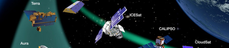
5. Students will be able to identify the different satellites and their sensors on board along with their applications |
|
6. Derive data from remote sensing systems and incorporate them in initialization and validation of forecast models.
|
6. Students will be able to manipulate statistical and software techniques (Matlab, IDL or Hydra) for model development |
| Grading Procedure: | |
| Midterm | 15%; |
| Project | 25%; |
| Laboratory | 30% |
| Final Exam | 30% |
| Week | Topic | Reading assignments | Homework | laboratory Assignments |
| 1 | Electromagnetics basis
Electromagnetic waves, polarization, spectra and Fourier transform, the Doppler effect, angular distribution of radiation, thermal radiation, diffraction |
Pg. 33-45 | Problems 1-4/ Pg 29,
Problems 1-5 / Pg 53.
|
Lab 1: Online remote sensing data resources (Aeronet, Hysplit, NASA, NOAA, etc). Analysis of the downloaded data using Matlab program. |
| 2 | Interaction of electromagnetic radiation with matter
Propagation through homogeneous materials, Plane boundaries, volume scattering, reflection and emission from real materials |
Pg. 48-53 | Problems 6-10 /Pg 53.
|
Lab 2: HYDRA software used for data processing and image display. HYDRA Commands. |
| 3 | Interaction of electromagnetic radiation with earth atmosphere
Molecular absorption and scattering, microscopic particles, large particles, radiative transfer equation, propagation through the atmosphere |
Pg. 63-70 | Problems 1-10 / Pg. 101
|
Lab 3: Field trips, Internet data downloading |
| 4 | Electro optical remote sensing system
Spectral Imagery VIR imaging systems, Thermal infrared imagers, Atmospheric sounding |
Pg. 157-170 | Problems 1-4 /Pg 178
|
Lab 4: Interferometer Measurements of Atmospheric Absorption |
| 5 | Orbital mechanics
Gravitational force, circular motion, satellite motion |
Pg. 103-115 | Problems 1-7 / Pg 115
|
Lab 5:Calculation of satellite motion, circular motion, orbital elements and standard orbits |
| 6 | Remote Sensing of the Earth’s surface and
atmosphere General considerations, Projects assignments |
Pg. 117-127 | Problems 1-5 / Pg 136
|
Lab 6:Using HYDRA to Inspect Multispectral Remote Sensing Data
EXAM |
| 7 | Remote Sensing of the Earth’s surface and
atmosphere (e.g. ocean color, snow/ice, vegetation, fire, aerosols, & ash) |
Pg.127-136, Handouts | Problems 6-10 / Pg 136 | Lab 7: Analyzing MODIS data viewing land, ocean, and atmosphere |
| 8 | Clouds, SST, and Moisture Sensed with MODIS
Cloud masking, sea surface temperature algorithms, |
Handouts | Handout problems
|
Lab 8 : Understanding Multispectral Cloud Properties sensed with MODIS |
| 9 | Investigations with High Spectral Resolution Sounders
Atmospheric trace gases, absorption features over water and over clouds. On-band and off-band investigations |
Handouts | Handout problems
|
Lab 9 : Staging,
Viewing, and Interrogating AIRS Data
|
| 10 | Spectral Signatures seen with AIRS
Spectral signature of opaque clouds, temperature profiles, contrast |
Handouts | Handout problems
|
Lab 10 – Exploring
Spectral Properties of Clouds, Moisture, and Volcanic Ash Sensed with AIRS |
| 11 | Ranging Systems
Laser profiling, Radar altimetry laser remote-sensor system |
Pg. 179-208 | Problems 1-6 / Pg 208
|
Lab 11: Field Trips |
| 12 | Scattering Systems
Lidar equation, radar equation, DIAL equation, geometry of receiver optics, solution of the lidar equation |
Pg. 211-218 | Problems 1 / Pg 224, Handouts,
|
Lab 12: LIDAR systems and vertical profiles (Using Matlab software) |
| 13 | Atmospheric Lidar applications
Atmospheric studies, spaceborne lidar operation, |
Pg. 218-224 | Handouts (Matlab codes)
|
Lab 13: LIDAR backscatter and extinction profiles (Matlab) |
| 14 | Data Processing
Transmission and storage of data , image processing Atmospheric models Climate models, community models, weather prediction forecast models WRF, CDAS http://www.ncar.ucar.edu/tools /models/modelslist.php , http://wrfmodel.org/users/users.php, http://cdaweb.gsfc.nasa.gov/ |
Pg. 137-156 | Problems 1-5 / Pg 156
Handouts |
Lab 14: Elements of recognition (shape, size, shadow, height, etc), filters, histograms (Matlab) |
| 15 | FINAL EXAM
|
Project
presentations |
|

