Post 1
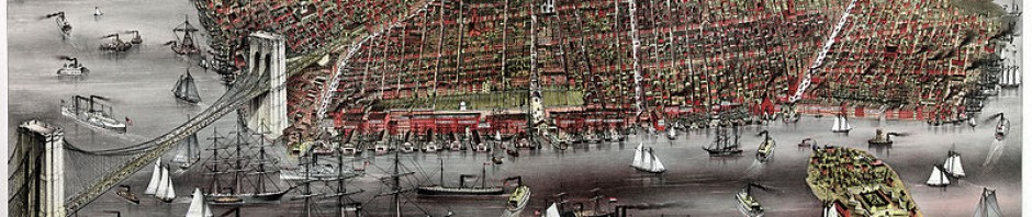
Honestly till yesterday I never walked past the college campus. It was always from the train station to school from school to the train station, so when I heard about this walking tour around downtown Brooklyn and Brooklyn height didn’t call my attention much. Starting out the tour I was amazed I hadn’t even seen the back side of the college and to see that there was so much passed Jay Street was fascinating. I never thought that Brooklyn had so much history none the less the history t does have. Something that was interesting to have learned was about the fire that killed 300 people. How something like that has an effect on us, because of that fire in the theater we now have a certain limit of people that can occupy a space at one time. Something else that really called my attention was to learn that Brooklyn was its own city at a point in time, one of the largest cities in the country. Entering Brooklyn heights was like entering a different world. It was fascinating to see how things can change so much in a difference of a couple of steps. It was so different, so beautiful that I fell in love with the architecture of the houses it was breath taking. It was really interesting to see that they were in exactly the same condition that they were in the 1800’s, due to the fact that the area is landmark. Landmarked meaning that the area of Brooklyn Heights can not be changed in anyway on the outside. My favorite part of the walking tour was our stop at the Brooklyn Heights Promenade. The park was so beautiful and the view was simply amazing. Something that we learned that was also interesting was now that the exact beautiful park we were standing in was once the backyard of the homeowners who live near the Promenade Now that I took the tour I would really recommend it to other because I learned a lot of information that I’m sure isn’t in textbooks.
Post 2
On this visit to the Brooklyn Historic Society we got the opportunity to look at all different types of maps. Some of the maps that we took a look at were fairly recent but there were also some the date back to the 1800’s and maybe even further back. When we first got there to the library we were first thought how to read and understand what a map is showing us. We also learned that map have many different uses. We also got the to see the progression of maps thought out the years, how they became more modern with time. I found it so interesting how maps were used and even how they were made back in the 1800’s. After we saw the different type of maps, we were separated into groups to look at some other maps. The maps that were in the groups all range from different time eras. My group got to look at some maps that all had different purposes some showed streets of Brooklyn Heights and Downtown Brooklyn and others were subway maps. One of the maps that my group was a personal map of the Pierrepont family that was very simple no colors expect for the color green that represented trees and parks. Then we looked at a transit map that was one of the newer maps. Observing the maps we realized that the map had some lines that no longer exist but we also recognized some lines such as the 7 line in Queens and the F train the run from Queens into Brooklyn. The last map we looked at was a map of Downtown Brooklyn that showed all the commercial areas such as Fulton street. The map was the most modern, published in 2005 contain a map key that helps the person looking at the map located places on the map. I enjoyed this trip to the Brooklyn Historic Society I learned a lot about maps that I didn’t know before but can definitely use sometime in the future.
Reflection
Not everyone in their first semester of college gets the opportunity like we had. This semester was one to remember. From the walking tour to what we learned in class is something we will all take with us and not ever forget. We started out the semester with the walking tour of Brooklyn heights and Downtown Brooklyn. From the walking tour I learned a lot. Something that I won’t forget that I learned on the walking tour was about the Brooklyn Heights Promenade. The story that Julie Golia shared with us that where we were standing once upon time was just simple backyards to the residents of Brooklyn Heights. Also that the Brooklyn Queens Expressway was supposed to cut straight thru Brooklyn Heights instead of around it like it does today. On our first official visit to the Brooklyn Historic Society we got the chance to learn about maps. All about how they were made, how much they cost, and how used it and how to read a map. We also show how throughout the years how maps have changed and became more modern. I really enjoy learning and interpreting maps in the library. It gave me the chance to really understand the change of Downtown Brooklyn and Even Brooklyn Heights. On the second visit to the Brooklyn Historic Society we looked at some different primary source documents. Some of the documents were diaries others were letter and we even got the chance to look at subway tickets for the long island railroad. I thinking looking at the tickets was the most interesting to me because I take the Long Island Railroad and to see how much it has changed in not only appearance but also in size. Over all the experience at the Brooklyn Historic Society Was an enjoyable. I not only had a good time I also learned along the way.


