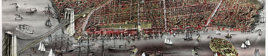
The other day when we all went to the Brooklyn Historical Society Library, all of us had the chance to see different types of map that had been created different historical time periods. After we had seen the maps then we’ve all placed in groups of two and three classmate with different types of map, and compare them with modern world today. I and my partner, we’ve assigned to a map name “The heart of Brooklyn” (A great shopping amusement). This map was published/drew some point of time in 1940’s, and it shows Atlantic, Fulton, Flatbush, Borough hall, etc represent the map of downtown Brooklyn. Moreover, during that time period the part of that area had a lot of things which have changed over the few decades. For example, it used to have the rail tracks which the map showed B.M.T and I.R.T, this were the tracks that had been used back in 1904. However, where in modern world today shows that they are replaced by 2, 3, 4, 5 subway tracks. For more info you can visit: http://www.nycsubway.org/faq/briefhist.html. Furthermore, we tried to find the NYC Tech College on the map, but we couldn’t see it. So, as alternative we had used the coordinate lines on the map and decided it belongs in the coordinate of 3 and A because that’s where the Jay st. and Johnson is. Therefore, this small activity had proved that as time passes by so as the change’s occur for many things, and who knows what we are observing today maybe next few years something else may place over.
-

Telling Brooklyn Stories:
English Composition I
ENG 1101, section 5381
Prof Jody R. Rosen
Fall 2011
M/W 1:00-2:15
Office Hours:
M 2:15-3:45
W 2:15-2:45 Behind the scenes
Categories
- Announcements (10)
- Assignments (9)
- Classwork (8)
- Cover Letter (1)
- Homework (4)
- Images (2)
- Instructions (4)
- Juxtapositions (2)
- Maps (3)
- Readings (1)
- Reflections (12)
- Research (2)
- Responses (4)
- Summaries (1)
- Uncategorized (49)
- Walking Tour (3)
- Writing (3)
Tags
- abolitionists
- archives
- B.M.T & I.R.T subway story
- Ben McGrath
- Brooklyn
- Brooklyn Heights
- Brooklyn Historical Society
- City Tech events
- Colson Whitehead
- communication
- drafts
- Essay 2
- Essay 3
- Essay 5
- Essay 6
- finals
- Jennifer Egan
- John Strausbaugh
- language
- learning communities
- libraries
- maps
- Margaret Atwood
- New York
- office hours
- persuasion
- photographs
- poster session
- quizzes
- real estate
- reflections
- research
- revision
- Saul Steinberg
- schools
- slavery
- summary
- support
- surveys
- The New Yorker
- thesis statements
- Truman Capote
- Underground Railroad
- vocabulary
- walking tours
-
Recent Posts
Recent Comments
- valentina on Summary of “On the Trail of Brooklyn’s Underground Railroad”
- Jeff on Essay #6
- Nayum on Summary of “On the Trail of Brooklyn’s Underground Railroad”
- stanleyd15 on Summary of “On the Trail of Brooklyn’s Underground Railroad”
- Account Deleted on Summary of “On the Trail of Brooklyn’s Underground Railroad”
Links
Archives
Meta

