![]()
CNU Conference June 2020;
Conference Presentation Proposal (accepted):
Public space in American cities often hinders rather than fosters diverse public activity including broad social activity and political assembly. Urban designers can use historic analysis of both formal configuration and social/political use patterns to assess the impact of design on the way an urban place has facilitated public activity and gatherings over time. From this analysis new strategies for urban space design can emerge.
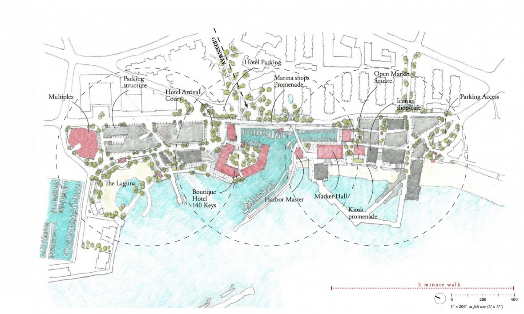
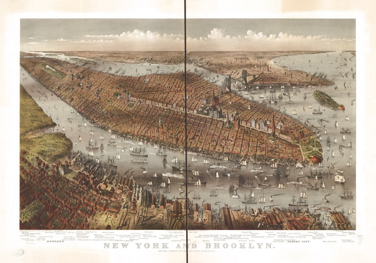
The urban space in front of Brooklyn Borough Hall (formerly City Hall) provides a rich database of 160 years of changing configuration and patterns of use. Historic photographs and fire atlas maps provide a rich collection of primary sources to study and analyze the evolving configuration of the space including the spatial definition and access points, traffic and transportation infrastructure, commercial activity, and landscape integration.
Urban designers in the 21st century should heed the lessons of American urban spaces like this one to guide and enhance the designs of new urban places where vital social mingling of diverse populations, civic celebrations and memorials, and open and peaceful political discourse can help rebuild critical social bonds and capital.
Conference Workshop Proposal (accepted):
The American city is a complex entity that has been significantly impacted by interventions that were not always sympathetic to the nature of place. Contemporary urban designers, architects, and landscape architects can benefit from developing diverse tools and approaches of investigation that can help them understand the nature of place as they begin a design process. This session combines historic analysis with observational drawing, offering participants the opportunity to hone field investigation skills through an open inquiry-based approach. The workshop will provide a observation-based model of investigation of urban places as an additional tool for building a knowledge base of the unique characteristics of a city, urban quarter or neighborhood to guide urban designers, landscape architects, and architects.
This session will take place in Rice Park and Landmark Plaza, a complex of two urban spaces with compelling geometric qualities on the edge of the primary grid of St. Paul’s city center. The urban composition of this place offers participants an opportunity to study the relationship of figural buildings to urban space and discern the characteristics that make this place a special example of American urbanism.
This workshop has roots in Visual Notes, a seminal book for this type of field work with the overlay of life-drawing and picturesque sketching techniques for increasing focus and concentration to facilitate careful observation.
There will be three stages to the workshop:
Stage 1: Urban Evolution
Participants will use historic maps and photographs to orient themselves to the place and gain insight into how it evolved over time. These maps will provide a basis for diagraming the urban configuration of this important site in St. Paul. Participants will develop sketchbook diagrams of the timeline of the urban condition, focused on the significant moments of change.
Stage 2: Honing a Discerning Eye: Investigating the Quality of Place
Participants will develop a series of 5 minute sketches/vignettes of key views, architectural compositions, landscape and street conditions. These sketches warm up the observation “muscles”, allowing the participants to engage with the place and activate their sensory focus.
Stage 3: Place Documentation: Selecting and Developing the Drawings to Summarize Observations
Participants will select the critical quality of the place through their diagrams and observations and carefully develop a detailed documentation of this aspect of the place. This may include a cross section/elevation of the public space with the defining building masses that includes building scale, spatial and architectural proportions, architectural features and details. It could also include an axonometric view of the public space complex, studying its geometrical complexity, spatial definition, and relationships between the urban spaces and the civic buildings that define the spaces.
Email Coordination: CNU 28 session The Art of Observing and Analyzing the City Plein Air Techniques
Email notification of accepted proposal: Session proposal for CNU 28Twin Cities

