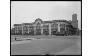
 An interdisciplinary ESP team of students from Arch Tech, En Tech, and CIS completed the construction of a database that contains information and images on over 400 historical theaters in NYC. The information in the spreadsheet was then used to build ESRI Story Map (GIS) (the map itself was designed by Dr. Swift). Students will research in books, online and in physical archives, entering links to images and resources to the master spreadsheet. They will learn about how to use archives at the NYC Performing Arts Library and the Brooklyn Historical Society. They will record bibliographic information throughout.
Deliverable: ESRI Story Map, The City Performs: Architectural History of NYC Theater


