1-What is the map’s call number?
BA-[194-3].F1
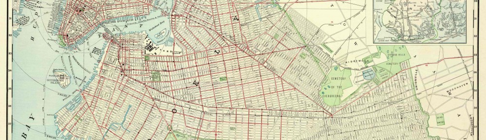
2-What is the map’s title (if available)?
The Heart Of Brooklyn
3-Which collection does the map belong to?
Flat Maps
4-When was it made?
In the 1940’s
Physical description of the map:
5-What size is the map (approximately)?
14 inches by 22 inches
6-What colors does it use?
Gray, Pink, Green, Orange, Red, Blue, White, Yellow, Purple
7-What materials were used to make the map?
Paper
8-Who made the map?
It was printed by Hagstrom Company,Inc.,N.Y.C.Map Makers,Map Publishers. It was made by the Brooklyn Trust Company
Map content:
9-What location does the map depict?
Brooklyn Heights
10-What details does it include?
Retail stores, Theaters, Business and Finance, Automobile parking
11-What time period does the map depict? Is this the same as the time when it was made?
It depicts the 1940’s and it seems it was made around the same time
12-What is familiar to you about the location depicted in the map?
All the streets and designed areas seem similar to current
Interpretation and Reflection:
13-What is the purpose of the map?
To attract people to the area of Brooklyn for tourism
14-Why did it survive prior to becoming part of the archives at BHS?
It is very informative and was probably useful from when it was made until today
15-Why did BHS incorporate it into its collections?
It has to do with Brooklyn
16-What is familiar or unfamiliar about the map?
Everything is familiar street-wise. The style of cars and clothes is from an older time
17-What additional information would you want to better understand the map?
A scale
18-Where is City Tech in relation to this map?
The intersection of Johnson and Pearl street

