SPECIAL WEST CHELSEA DISTRICT

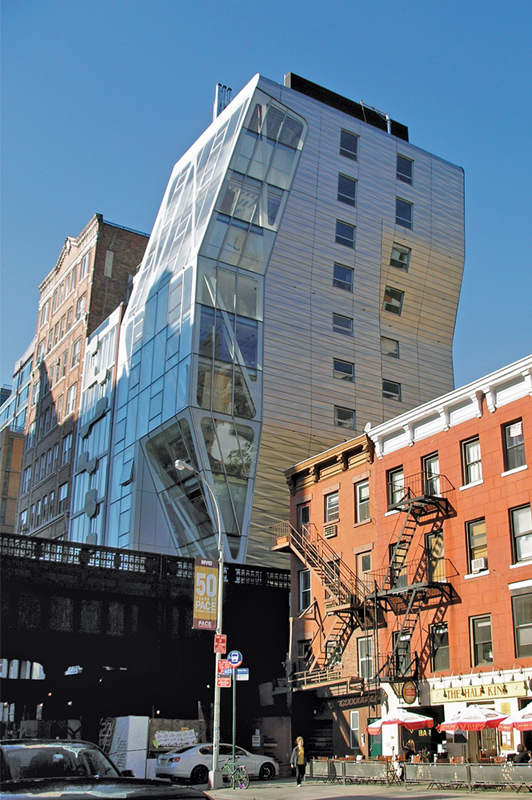
The Special West Chelsea District (WCh) provides a regulatory framework for the continued development of a dynamic mixed residential and commercial area centered around the public open space created by reuse of the High Line, a former elevated rail line running north-south through the length of the district. Bounded generally by Tenth and Eleventh Avenues between West 16th and West 30th Streets, the district contains regulations to facilitate enjoyment of the High Line including a floor area transfer mechanism to preserve light, air and views as well as floor area bonuses related to access and open space development. Special bulk regulations respond to unique conditions along the High Line and the areas surrounding West Chelsea, including the Hudson River to the west, the higher-density Special Hudson Yards District to the north, and the lower-scale Chelsea Historic District to the east. The Inclusionary Housing designated area Program facilitates development of affordable housing to ensure an economically diverse neighborhood.
SPECIAL HUDSON YARDS DISTRICT

The Special Hudson Yards District (HY) was established to foster a mix of uses and densities, provide new publicly accessible open space, extend the Midtown central business district by providing opportunities for substantial new office and hotel development, reinforce existing residential neighborhoods and encourage new housing on Manhattan’s Far West Side. The special district includes two new corridors for high-density commercial and residential development supported by a subway line extension, new parks and an urban boulevard. New mid-density residential development will form a transition to existing residential neighborhoods and the Special Garment Center District to the east.
The district mandates a variety of use, bulk and urban design controls applicable to six subdistricts. In certain zoning districts, the maximum floor area ratios of the underlying districts may be increased through a District Improvement Bonus mechanism (alone or in tandem with the Inclusionary Housing designated areas Program that would support financing of specific capital improvements in the area. Transfers of floor area are also permitted under certain conditions.
Flexible as-of-right height and setback controls accommodate large floorplate office buildings and allow for creative design within the predominantly commercial areas. Mandated improvements include retail use on major corridors, street wall continuity, pedestrian circulation space, plantings, subway entrance easements, and screened or below-grade parking. The district has unique off-street parking regulations that manage the total amount of parking that can be constructed in the district as it is developed.
SPECIAL BATTERY PARK CITY DISTRICT

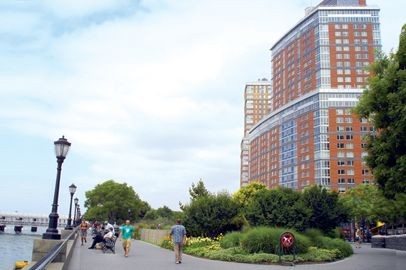
The Special Battery Park City District (BPC) was created, in accordance with a master plan, to govern extensive residential and commercial development in an area on the Hudson River close to the business core of Lower Manhattan. The central component of the master plan is an office complex flanked by two large residential neighborhoods extending south to The Battery and north to Chambers Street. A continuous esplanade providing public access to the Hudson River waterfront is a major element of the plan. The district regulates permitted uses and bulk within three specified areas and establishes special design controls with respect to front building walls, building heights, waterfront design and parking.
SPECIAL DOWNTOWN BROOKLYN DISTRICT
101-00

The Special Down town Brooklyn District (DB) establishes special height and setback regulations and urban design guidelines to promote and support the continued growth of Downtown Brooklyn as a unique mixed use area. The economic, civic and retail center of the borough, Downtown Brooklyn is the city’s third largest central business district — a hub of office buildings, courthouses and government buildings, major academic and cultural institutions, and active retail corridors. It is surrounded by historic residential neighborhoods.
Flexible height and setback regulations for a range of moderate- to high-density residential and commercial zoning districts facilitate development on the small, irregularly-shaped lots typical of Downtown Brooklyn. The higher density zoning districts allow either Quality Housing buildings with height limits or towers-on-a-base without height limits. The Inclusionary Housing R10 Program, which offers incentives for the provision of affordable housing, is applicable in the highest-density zoning districts. The moderate-density zoning districts allow for flexible building envelopes with height limits. A height limitation area is designated on Schermerhorn Street and Flatbush Avenue Extension as a transition between the high-rise core of the central business district and adjacent residential neighborhoods. Urban design guidelines promote ground floor retail and street wall continuity, storefront glazing, sidewalk widening, curb cut restrictions and off-street relocation of subway stairs.


