Ground Plan is a drawing to show you the overview of the location. There you can see the measurement positions and layouts of the drawing. This helps you understand the drawing more.
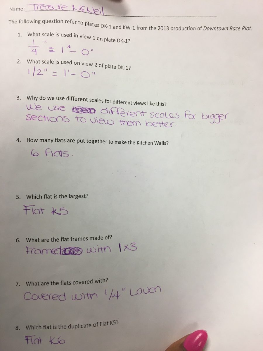

Ground Plan is a drawing to show you the overview of the location. There you can see the measurement positions and layouts of the drawing. This helps you understand the drawing more.
The OpenLab is an open-source, digital platform designed to support teaching and learning at City Tech (New York City College of Technology), and to promote student and faculty engagement in the intellectual and social life of the college community.

