안녕하세요!
Hello!
The southern half of the Korean Peninsula (750 miles long) is in East Asia.
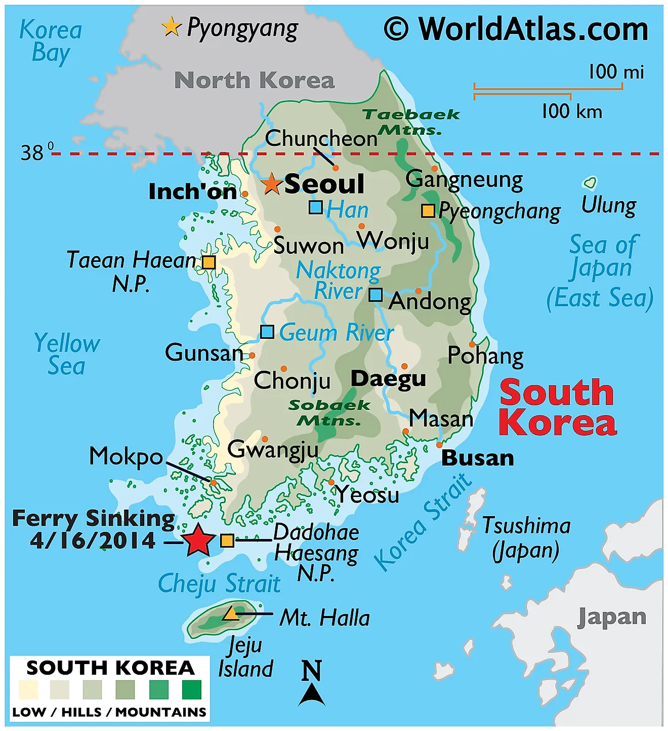
- Borders: North Korea to the north, encircled by the Sea of Japan and the Yellow Sea.
- Land: Mostly mountainous, the Taebaek Mountains create a natural boundary with North Korea.
The southern half of the peninsula is occupied by South Korea; to the north is North Korea, and to the sides are the Sea of Japan and the Yellow Sea. With the Taebaek Mountains creating a natural border between North and South Korea, the majority of its land is hilly. The climate, natural resources, and cultural landscape of South Korea are greatly influenced by this country’s mountain geography and coastal regions.
South Korea has a range of climates due to its diverse landscape. Winters are chilly and generally dry, but summers are hot and humid, frequently influenced by the North Pacific anticyclone. The rainy season, known as Changma, lasts from late June to early September. This seasonal difference has an influence on everyday life and economic activity in South Korea. Confucian ideals have had a significant impact on Korean society, emphasizing respect for elders, family, and tradition, as seen in everyday rituals and business conduct. Education and humility are highly respected, influencing both personal and professional relationships.
A map of South Korea showing borders and coastlines:

Example of traditional Korean dress:
An example of a traditional South Korean educational setting:


Hi, this is a comment.
To get started with moderating, editing, and deleting comments, please visit the Comments screen in the dashboard.
Commenter avatars come from Gravatar.