Many thanks to Living Lab Third-Year Fellow Jason Montgomery for capturing Friday’s walking tour! Here are just a few of his many fantastic photos from our tour [see more photos]
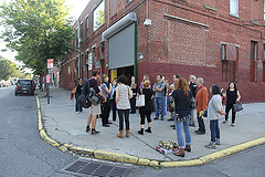
Many thanks to Living Lab Third-Year Fellow Jason Montgomery for capturing Friday’s walking tour! Here are just a few of his many fantastic photos from our tour [see more photos]
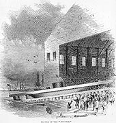
Image of the launch of the USS Monitor, published in Harper’s Weekly, 1862
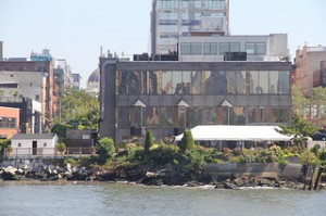
Shipbuilding was one of the largest industries along New York’s waterfront throughout the 19th century. Established in 1859, the Continental Iron Works built the first Ironclad battleship, the USS Monitor, famous for fighting in the Battle of Hampton Roads. Assembled at this site and launched nearby, the remains of the ship are on display at the Mariners’ Museum in Newport News, VA. The Continental Iron Works received several contracts to build more ironclad battleships. After the decline of the shipbuilding industry, the Continental Iron Works specialized in other metalwork for marine and military uses.
The 2005 rezoning called for a continuous waterfront esplanade and several parks; the Greenpoint Monitor Museum site is in the path of the planned open space. Advocates for the museum were awarded a parcel of land for the museum, yet the land is in the footprint of the planned park.
According to the city’s historic district designation report, pencil manufacturing took place here from 1872 until 1956. The buildings were partially converted to condos in 2010; some units remain commercial lofts. 61 Greenpoint Avenue, a later addition to the factory complex, has decorative panels that display the star and diamond motif that was impressed on every pencil, as well as oversize terra-cotta pencils. Early 20th century photos of the factory interiors show a predominance of women workers.
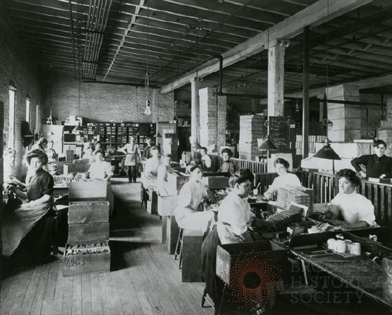
Women at work in the Eberhard Faber Pencil Factory, ca. 1915. Brooklyn Historical Society Collection.
Importing of sisal, manila and jute from south Asia and the Far East gave some area streets their names: India Street, Java Street. These raw materials were made into rope, which was in demand from the many shipyards that dominated industry here in the 19th century. Founded in the 1890s, the American Manufacturing Company grew quickly and was the second largest industrial employer in Brooklyn at the turn of the 19th century. After World War II, the now-sprawling yet obsolete facility became a warehouse, Greenpoint Terminal.
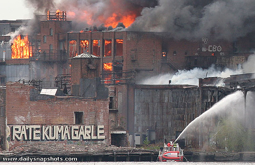
Greenpoint Terminal Market fire, May 2006. flickr user MGChan
After the 2005 zoning, preservationists wanted to landmark some of the significant industrial buildings of the complex. Many of its 19 buildings were destroyed or seriously damaged in a suspicious 2006 fire.
The Astral Oil Works, at North 12th Street and the East River, refined oil into kerosene, which was the main illuminating oil used in lamps before electric lighting. The company used the slogan “the ho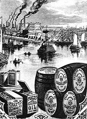 ly lamps of Tibet are primed with Astral Oil,” suggesting that this product dominated the kerosene market. The facility was devastated by fire in 1873, and suffered serious damage by fire several times thereafter: accounts in the Brooklyn Daily Eagle date from 1880, 1884, and 1887.
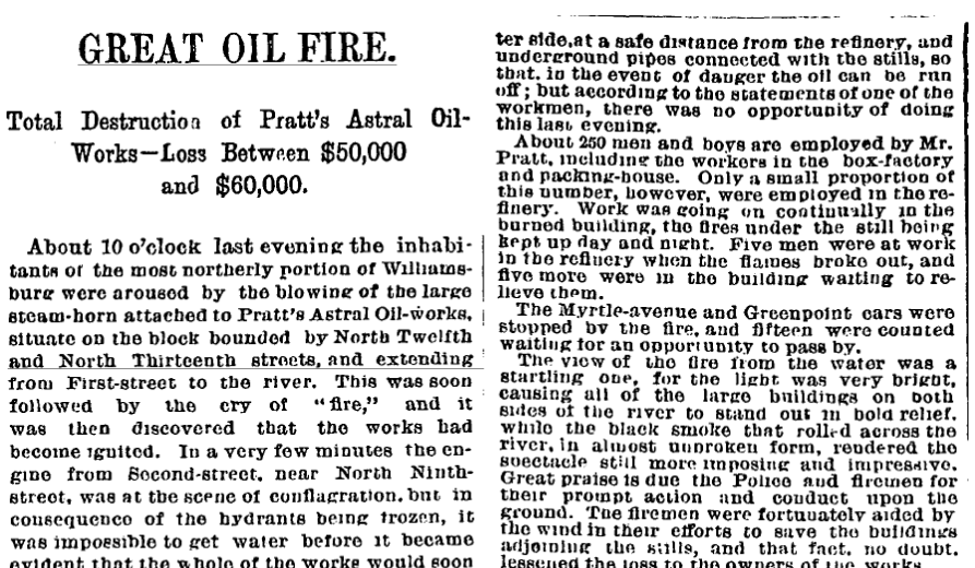
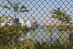
The topography of this area has been dramatically altered. Bushwick Creek extended over a mile inland and provided waterwheel power to early industries. It was completely filled in by the turn of the last century. Bushwick Inlet is the site of a proposed waterfront park, created in the 2005 rezoning; only the southernmost part of the park has been built.
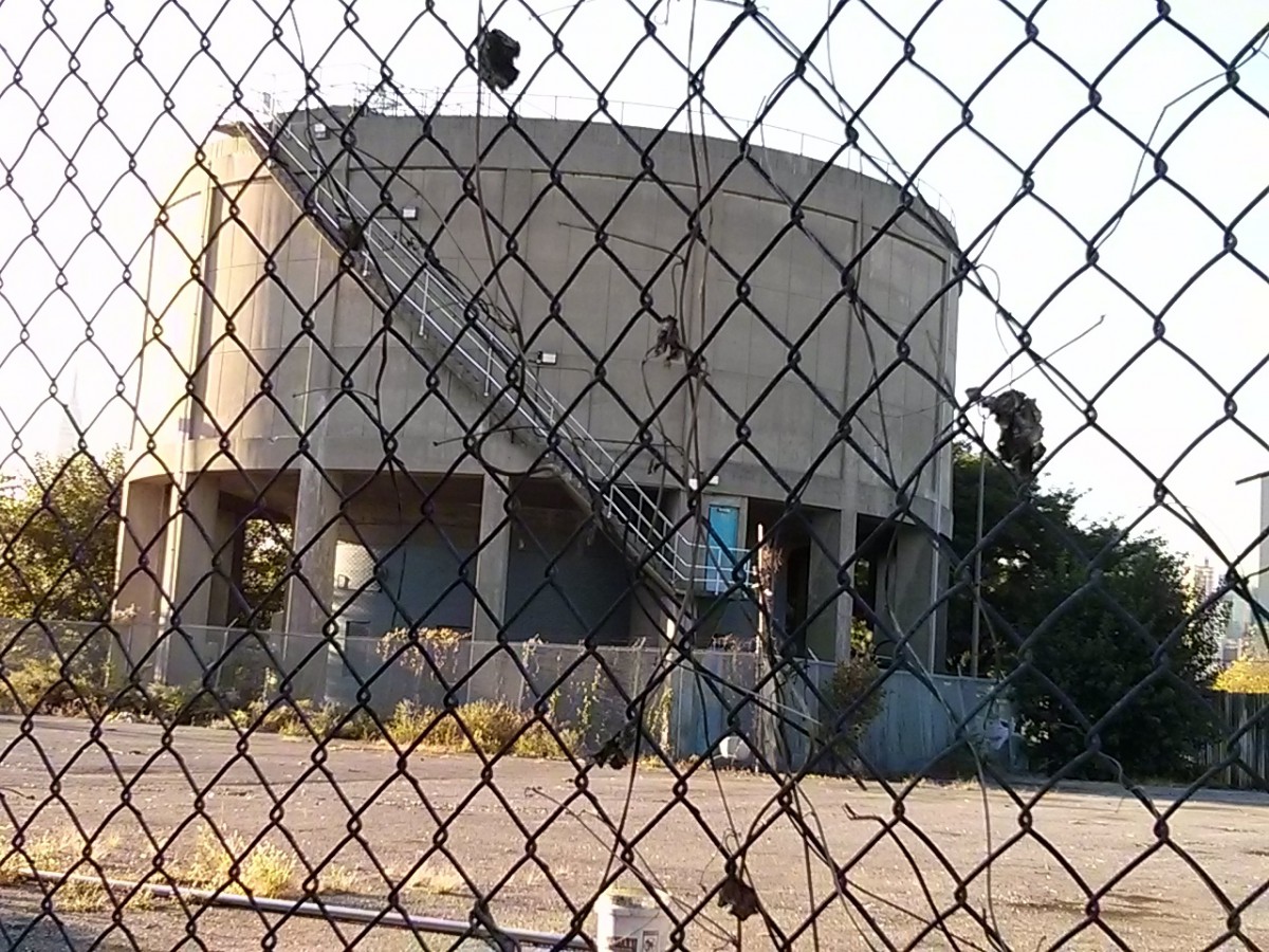
The 800,000 gallon sludge tank stored treated wastewater. It is scheduled for demolition to make way for waterfront condo towers.
The corner of Commercial Street and Dupont Street offers a view of the past, present, and future of Greenpoint. The Newtown Barge playground occupies the former site of the Newtown Creek Barge Terminal and, with the adjacent Greenpoint Playground, is one of the few open recreation spaces in the neighborhood.
The prominent sludge tank, which stored treated sewage from the nearby wastewater treatment plant, is slated for demolition in early 2014. Under the terms of the 2005 rezoning, the land it occupies was 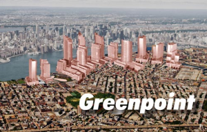
to become part of a waterfront park. Two massive new housing developments consisting of a dozen 30 to 40 story buildings, known as Greenpoint Landing and 77 Commercial Street, are planned for this site.
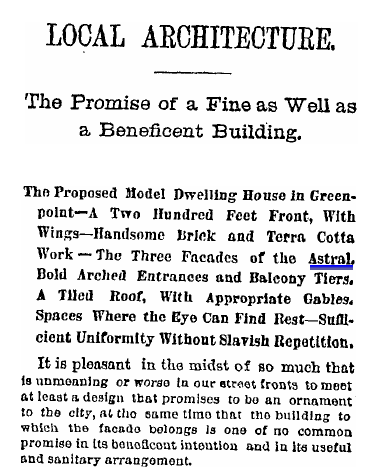 The Astral Apartments at 184 Franklin Street were built as workers’ housing for the employees of the Astral Oil Works, the kerosene manufacturing company founded by Charles Pratt. In 1887, the Brooklyn Eagle reported on this “Fine as Well as a Beneficient Building.”
Fire insurance and other maps from the 19th and early 20th centuries offer great detail about industries and land use in this area. This 1904 map shows the extent of the American Manufacturing Company’s facilities, as well as the location of the Continental Iron Works.
View larger map
from NYPL Digital Gallery
The 1899 map of Greenpoint below shows how the northwest Greenpoint waterfront was dominated by timber-related industries at that time. It has been georectified upon the contemporary street grid.
From NYPL Digital Gallery
This map, published in 1876 but based on surveys completed in 1777, shows “the original high and low grounds, salt marsh and shore lines in the city of Brooklyn.”
From NYPL Digital Gallery
Each stop on our tour:")
From Fulton Ferry Landing in DUMBO, we dismbark at the India Street pier and head east on India Street, turning north (left) on West Street to Eagle Street, up Franklin Street, then heading back west on Dupont Street to view the Sludge Tank and the future site of Greenpoint Landing. We return to Franklin Street and head south to #184, the Astral Apartments. We continue south on Franklin and take our third right onto Greenpoint Avenue. At the corner of Greenpoint Avenue and West Street we can observe the buildings that make up the Eberhard Faber Pencil Works and Historic District. Heading south, at the corner of West and Noble Streets we come to the site of the Greenpoint Terminal Market Complex. Heading south on West Street, we come to the site of the Continental Iron Works at the corner of Calyer. We return to Franklin and follow it south to Bushwick Inlet and the site of Astral Oil Works. We wrap up at the East River State Park, entering at Kent and N. 8th Street. [map]
The OpenLab is an open-source, digital platform designed to support teaching and learning at City Tech (New York City College of Technology), and to promote student and faculty engagement in the intellectual and social life of the college community.

