Beauty is something that you will encounter after you download this app. My co-workers and I, Ayano Morishima are making an route simulator known as “Route & Beauty” (Short for R&B) that takes the user to a journey that can lead them to a beautiful location. Many people uses other apps to locate their shortest route, so that they could get to their location much faster. What if there is a app that can take you to the location, where the route is short, fast, and beautiful? One of the ongoing project route is shown below.

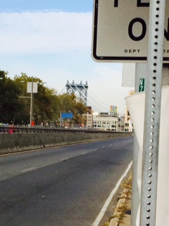
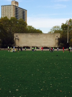
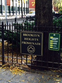
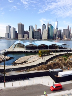
These exampled location is a place where the users will encounter in the app. Such as the caption below will pop up to explain a little information that the user could do, when they arrive at certain locations. Many volunteers contributed to this route making, so that it shows the best time to go to the location, where it also shows the “best time” to go to the location at the top right corner. An example for the location above is, “the best time to go to the location” is between 2:30pm to 5:30pm. One of the volunteer commented, “Its a great place to go, especially since it is quite. You can see how houses are made of different structure comparing it to different locations. Going with friends or family would be a great way to explore a new route!”


I like how you added pictures and captioning for the pics. It added more history about the places. Also I like how you’re thinking of an app already.
You’ve incorporated the concept of Project #3 very well. Now think back to how you got to each of these places and write the directions that would guide someone from City Tech to each of these locations, and ultimately on their way to their next destination (home, work, etc). Would it make sense to travel toward City Tech (Voorhees) from the train, stopping at all of these locations, or from Voorhees to the train, with these as stops along the way?
I see the theme right away as soon as I start reading your passage and I can see it through those pictures and I like the captions you put under the pictures explaining the location.