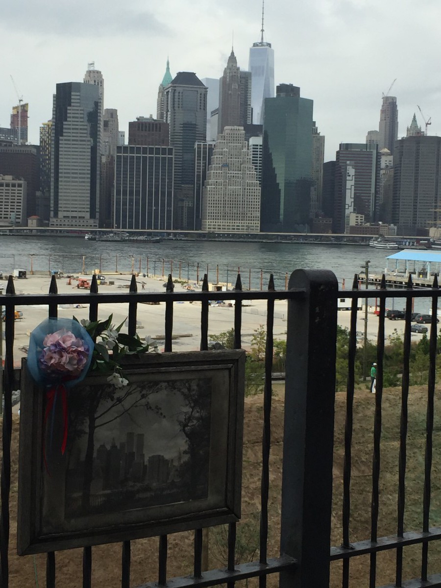
For this Project I chose to go too Brooklyn Heights. Before I left I looked a bit into how to get there using the map app on my phone but otherwise I didn’t use my phone until I got too my location so I could look at all the nice buildings that people get to live in. I got there by exiting the Namm building and turning left down on Jay Street towards Tillary Street. From there I made a left on Tillary until I got to Clinton Street you know that you’re going the right way because on your left is a small park dedicated to all the Korean war veterans. Keep going on Clinton Street until you hit Pierrepont Street. When i arrived at Pierrepont Street I follow it looking at all the nice buildings and how many of them differ from each other and how much they differ from the buildings I’m used to in Times Square, until I finally arrived at Brooklyn Heights. There you can see the huge differences between the small building in Brooklyn Heights and the huge towering buildings of Manhattan. While I was there I also saw a photograph of the old New York skyline with the twin towers tied to the fence. I thought that it offered a bit of insight into someone else’s New York. It’s also a really nice place where you can just sit and admire the view of the Brooklyn Bridge and the New York skyline.


Brain Storm:
The picture I posted shows two different New York’s In The picture there is a picture in a frame with the twin towers in the skyline which shows a different side of New York that someone else has experienced. While the present day skyline has the Freedom Tower which too others is their New York. Also in the picture that I was not able to post it shows the differences in design between the huge buildings in Manhattan and the smaller buildings in Brooklyn Heights.