The topics presented by Mr. Alexiou throughout his presentation on the Gowanus Canal convey vital material adding to previous knowledge gained by research and reading his book, “Gowanus”. During his presentation, Mr. Alexiou touched on many subjects that relate to Brooklyn’s development as it correlated with the Canals transformation. Some of these topics ranged from plans of real estate development, the First Maryland Regiment (Smallwood’s Regiment) and Superfund versus the City Of New York, more specifically former Mayor De Blasio. Canal’s timeline as one that regularly caught many futurists with its potential to become a trade hub. The topic that caught my interest the most was the transformation of the Canal, the effects of business and how the urbanization of the surroundings of the canal has affected its shape over the years. Throughout my paper, I will touch briefly on each historical moment that has contributed to the Canals current state.
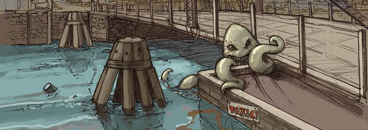
Mr. Alexiou described the Gowanus Canal’s historical timeline as one that reflects development without proper policies or guidance. After gaining its name from the local tribe of Native American Canarese’s, the Canal later was purchased by the Dutch who considered the creeks environment fit for farming oysters resulting in the Canal becoming lucrative. While farming was becoming big in the areas surrounding New York the need for docking facilities grew increasing interest of the creek, which eventually turned in a Canal. In the late 1860s, the Canal began to flourish as many factories and residential communities began to pop up along it. Some of these factories included coal gas manufacturing plants, oil refineries, machines shops, soap makers and chemical plants. The Canals industrial and residential growth then grew rapidly piloting, even more, development in areas around it. These areas include the neighborhood of South Brooklyn which encompasses, Carroll Gardens, Cobble Hill, Boerum Hill, Park Slope, Red Hook and Gowanus. The growth of these areas facilitated the need for sewage which then was routed into the Canal. Combining the lack of environmental policies in the early to late 1860, the Canal was subject to pollutants from runoff water, sewage overflow and the many refineries located alongside the canal. It is now known as one of the most polluted areas in Brooklyn and garnered the attention of many environmentalist agencies that have put programs in place to give life back to what started as wildlife marshland.
My feedback to the Gowanus’s timeline is one of utter shock and disbelief. It is described as a place throughout the presentation as a habitat for wildlife and rich for farming. But due to growth, pollution the area lost its potential yield produce. The influence of businesses and community turned a once fertile land and booming creek into an area of pollution and lifeless murky bacteria-infested waters. The canal has been a subject of pollution for quite some time since its development in the 1860 and is in the spotlight today for treatment by the Environmental Protection Agency. They plan to use the EPAs Superfund model which requires them to seek finances from different parties who are connected and responsible for contributing towards the pollution of the Canal. I am for the Superfund model as it imposes companies to mandatorily pay towards the cleaning efforts of the Canal. This model will pilot the efforts to remove the thick toxic sediment which sits 10 feet high below the Canals waters. The timeline of the Gowanus can serve to many different cities or countries on how to better develop policies to ensure that the environment is protected from tragedies like this one.

